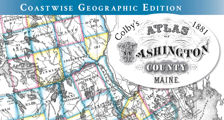
If you enjoy exploring old maps, photos, and other pathways of Downeast history, you’ll find inspiration in artist-editor Jane Crosen’s new Coastwise edition of Colby’s 1881 Atlas of Washington County.
For over 40 years the Penobscot mapmaker has been creating hand-drawn maps of Maine coastal and lake regions, published as posters, cards, T-shirts, flour-sack towels, trays, and other items. As her Maine Mapmaker product line has grown, so has her interest in exploring Downeast Maine’s historic landscape through maps.
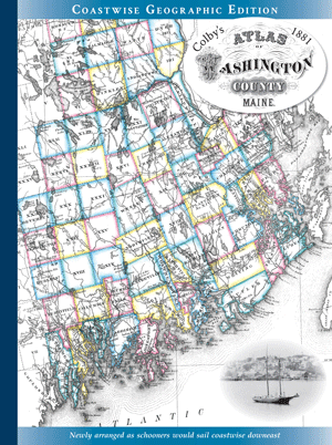
In 2020, Crosen published a geographically arranged “Coastwise” edition of George N. Colby’s 1881 Atlas of Hancock County, expanded with period photos and excerpts as a time capsule of Downeast’s 19th-century coastal economy in the age of sail and steam.
The edition is Crosen’s love letter to Washington County, which she had gotten to know somewhat through three decades
After the Hancock atlas, she conceived of a Coastwise edition of Colby’s 1881 Atlas of Washington County as a companion volume. It would prove a longer but more interesting journey, with Sunrise County having twice the number of towns and townships in a much larger area—and with more margin space for period photos and excerpts complementing the maps.
Compiled and published by George N. Colby, the original Atlas of Washington County, Maine, (1881) was drawn in Machias and engraved and printed in Philadelphia; only 300 hand-colored copies were printed, now collectors’ items.
Digitally archived scans and black-and-white facsimile editions have kept Colby’s historic maps available for public access, but they weren’t in any kind of order, making it hard to correlate maps and find places.
Crosen, envisioning “a way-back edition of the Maine Atlas and Gazetteer,” wanted to present Colby’s historic maps in a more user-friendly format for today’s explorers, grouping related maps—towns, villages, timber lot plans, based on charts and surveys—in geographic order, “as schooners would sail coastwise Downeast with the prevailing winds.”
The edition is Crosen’s love letter to Washington County, which she had gotten to know somewhat through three decades selling her wares at the Machias Blueberry Festival, exploring along the Airline en route to her camp on a lake near Wesley, and in adventures around Grand Lake Stream. In researching period photos and captions to round out the atlas with historic context, she found much more to explore in Washington County’s rich cultural landscape.
While she expected and found many themes in common with Hancock County, like shipbuilding and lumbering, she soon realized Washington County had its own stories to tell, varying with its diverse landscape.
“From the outwash plains, I found tales of glacial history and blueberries, the Baseline and Coast Geodetic Survey, along the craggy granite coast and bold volcanic cliffs, tales of schooners and lighthouses, shipwrecks and life-saving.
“On Passamaquoddy and Cobscook bays, tales of borders and battles, customs and smuggling, tides and sardine canneries, and on the Downeast rivers, tales of sea-run fish and salmon hatcheries, dams and log-driving.
“From the inland hills and waterways, tales of canoe routes and the Airline, game and guiding.
“And all around the St. Croix, Dennys, and Machias watersheds, I found the anglicized place names and enduring presence of the Passamaquoddy whose ancestral homelands span eastern Maine’s shores, facing the dawn.”
To make the maps and local history more accessible for today’s users, including explorers of genealogy and old deeds, Crosen has added a comprehensive index correlating historic place names (many changed since 1881) with their current ones. It includes a sidebar on the Passamaquoddy heritage found in many place names in Sunrise County, the traditional home of the People of the Dawn.
She hopes history buffs will enjoy sleuthing the new, old atlas.
“There is so much to discover and rediscover in Washington County where the past is still present in its well-preserved cultural landscape.”
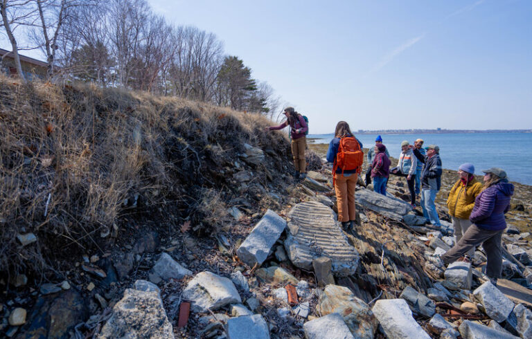
Colby’s remarkably detailed maps provide clues to locations of 19th-century buildings, Coast Geodetic Survey markers, rail spurs, millponds and mills, dams and dikes, lumber wharves and steamer landings—“historic features (or remnants) still in today’s landscape if you know where to look.”
Designed in collaboration with graphic designer Dede Johnson, Crosen’s new edition of the atlas was printed by Downeast Graphics in Ellsworth, launched in time to celebrate Washington and Hancock Counties’ new Downeast Maine’s National Heritage Area designation.
The Coastwise Geographic Edition of Colby’s 1881 Atlas of Washington County is available at local stores and historical societies, and at www.mainemapmaker.com.