Lots of us, I learned conversing a day later with friends, woke up around 4:30 on the morning of the great storm, hearing the wind slam around our houses, feeling our sound old homes vibrate with its ferocity.
Wind-whipped electrical wires attached to the house adjacent to my bedroom added to the racket. The door between the kitchen and wood room, latch-less and on a spring so the cat can let himself in and out, slammed time and again. I jammed it shut with the stiff sleeve of a barn jacket hung on a hook nearby.
Prowling from room to room, I found the only damage was a second story window pane had been sucked out and smashed on the ground outside.
There was no such thing as going back to sleep.
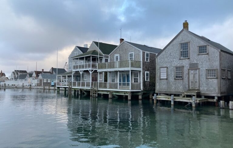
The bay lifted up one little cottage and set it down a little farther from the shore than before.
Fortunately, we lost no trees here, and our house sited on a high piece of island ground where we cannot even see water, sustained no water damage either from tide or rain. What a good thing the house had a new roof, because this storm would have peeled off the feeble asphalt shingles that covered it until October. For the thousandth time, I blessed my lucky stars that I didn’t own waterfront property.
I live up-island, the north end, past the Narrows, which was beaten up pretty badly in this storm, scattered with rocks, driftwood, seaweed, and beach gravel, and sections of roadway broken loose. Some traffic squeaked through; friends took pictures of waves crashing against a seawall installed years ago by the Army Corps of Engineers, flooding the only connection between North Islesboro and the firehouse, health center, and ambulance service, which are all located mid-island.
The ferry road, particularly the part closest to the terminal, was swamped at high tide, seawater flowing in from the southwest, Gilkey Harbor side, and from the low-lying northeast side. Plenty of other low-lying spots were underwater for a while, presaging the island’s future as even more of an archipelago than it is now.
Sections of shoreside lanes unprotected by rip-rap washed out, some homes saw water creep a heck of a lot closer than ever before and one friend reported being astonished at seeing waves splash against her living room windows.
The bay lifted up one little cottage and set it down a little farther from the shore than before. Nature inelegantly accomplished what the owner reckoned he would have to do anyway.
Still, Islesboro was spared the awful waterfront damage to fishing businesses that happened in Stonington and other spots. For years, fishing here is largely conducted from floats moored in Gilkey with fish shacks on them, reached by small boats from the town pier.
One yacht yard, though, reported seeing water where it has never been before; the other yard is located at the top of a hill which will never see water even if Antarctica melts. That yard hauls boats all the way down a long steep road to launch them into a cove.
None of the flooding here surprised. Quite a few years ago, when I was still on the select board, the town hired a company to model likely sea level rise scenarios, and its report showed us where we could expect to see high water. During this storm, flooding occurred right in the places predicted.
Fortunately, in November 2019, Islesboro established a town sea level rise committee which has charged engineers with finding ways to keep the island connected through the Narrows on the town-owned roadway. In a few months, they will offer Islesboro four different solutions to the Narrows project. The flooded ferry terminal and roads leading to it are owned by the state, making it responsible for their maintenance.
During the 36 years I’ve lived here, I’ve watched our shoreline nibbled away. At the Narrows, the grassy edges of Crow Cove show erosion. Similarly, Hutchins Island Preserve used to have a generous approach with solid land several feet in from the water’s edge. Gone, much eroded now, and this storm broke through the shoreline to a freshwater pond. I recall oak trees growing where Main Road skirts the shore at Bounty Cove, just above the Narrows, but one by one they have fallen, undermined by a shoreline creeping closer, revealing stony ledge.
While sea level doesn’t rise evenly or even noticeably, water expands as it warms, growing in temperature in the Gulf of Maine than elsewhere, and then together with warmer air at the time of astronomical, so called “king” tides, create the damaging surges that change the shape of our island home and will continue to do so.
We better get used to it.
Sandy Oliver is a food historian who lives, gardens, cooks, and writes on Islesboro. She may be reached at SandyOliver47@gmail.com.