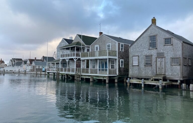
How blue is Casco Bay?
Friends of Casco Bay is recruiting volunteers to help monitor water quality by observing the color of the water. The color of estuaries and bays can be an indicator of nutrient and sediment concentrations and phytoplankton production. With a simple smartphone photograph, volunteers can provide a broad snapshot of the bay in space and time.
“We are putting a modern spin on a century-old scientific technique to assess water quality,” explained the organization’s bay keeper, Ivy Frignola. “This pilot project uses an electronic version of the Forel-Ule color scale. For more than a century, marine scientists have used the Forel-Ule scale to document the color of oceans and lakes. This color index assigns a numerical value to water color, from 1 (indigo blue) to 21 (brown),” she said.
Trends in water color over time will show if pollution prevention activities on land are successful. Lots of phytoplankton make the water appear green. Brown or yellow can indicate eroded sediment from land; studies of the Gulf of Maine suggest it is becoming more yellow.
A team led by William Balch of Bigelow Laboratory for Ocean Sciences has been sampling the waters of the Gulf of Maine regularly over the same transect for the last 18 years as part of a NASA-funded study. The researchers found that the amount of dissolved organic material from rivers emptying into the Gulf of Maine has increased, tinting the ocean yellow and absorbing light needed by the photosynthetic organisms that are the center of the marine food web.
To date, 178 people have taken 387 color measurements of Casco Bay, with values ranging from a dark chartreuse to royal blue. Over time, it will be easier to interpret trends and meanings behind the color measurements. To learn more or volunteer, visit www.cascobay.org/color.
Comparing water quality data for Midcoast estuaries
Since 2014, watershed organizations in the Midcoast region have been collaborating to monitor water quality in coastal rivers from the Harraseeket River in Freeport to Goose River in Rockport.
Sarah Gladu of Damariscotta River Association and Kathleen Thornton of the University of Maine’s Darling Marine Center recently reported on the activities of the Maine Coastal Observing Alliance. Before the groups decided to coordinate, said Gladu, some were already collecting water quality.
“Now, with the Alliance, they can compare their data to other areas to understand how the estuaries are doing,” she said.
Staff and volunteers measure dissolved oxygen, salinity, temperature, pH (acidity), total nitrogen, and water clarity at 40 locations. Although they have only been monitoring for four years, they have already learned how Midcoast estuaries differ and identified areas of concern. “Each estuary is unique,” said Thornton. Merrymeeting Bay, where the Kennebec and Androscoggin rivers converge, is much fresher because it has such a large watershed flowing into it. Deep channels in the Sheepscot keep the water cooler. Rockport, the outer Damariscotta, and Sheepscot have the clearest water.
“For the most part, these estuaries are doing really well,” said Thornton. Some of the data were surprising. In 2014, which was a relatively wet year, low pH and dissolved oxygen were detected in deeper water off Boothbay Harbor, apparently coming in from the Gulf of Maine.
“No one had ever seen that before. Everyone always assumed that low-pH water came from upstream, from rivers,” said Thornton. “These findings emphasize why we need to keep monitoring, because these pH levels are low enough to affect shellfish.”
The upper reaches of the St. George and Medomak rivers, and the Harraseeket had elevated total nitrogen concentrations.
“The next steps in sleuthing out where the nitrogen is coming from is to also test the freshwater coming into the estuaries, which we are doing this year in the Medomak, St. George and Damariscotta. Also, this year, I will be analyzing any samples that are high in total nitrogen for ammonium and nitrate which will give us more clues to the source,” said Thornton.
Members of the Midcoast Coastal Observing Alliance are Boothbay Regional Land Trust, Damariscotta River Association, Friends of Casco Bay, Georges River Tidewater Association, Kennebec Estuary Land Trust, Medomak Valley Land Trust, Rockport Conservation Commission, and Sheepscot Valley Conservation Association.
Bacterial pollution at coastal beaches
Citizen volunteers and municipal or park staff monitor water quality at 63 beaches from Kittery to Mount Desert Island as part of the Maine Healthy Beaches program. Samples are specifically tested for Enterococci bacteria, which indicate pollution from human or animal waste that can pose a human health risk.
Water quality in Maine is typically worse during warmer, wetter summers as these conditions mobilize bacteria from upstream sources and transport them to beaches via freshwater inputs (rivers, streams, and storm drains). Much of the work of the beaches program goes beyond routine water quality monitoring at beaches to investigating and eliminating pollution sources.
This summer program staff are working in the Goose Rocks Beach, Kennebunk River, Goosefare Brook, and Willard Beach watersheds to assist communities to identify, eliminate, and prevent human sources of bacterial pollution that may threaten beach water quality.
Catherine Schmitt is communication director for Maine Sea Grant.

What TO Read Next...