BACKGROUND
About a dozen miles from Rockland is the island community of Vinalhaven. The largest island in Penobscot Bay, both in terms of land mass and the number of people, Vinalhaven is not connected to the mainland by any structure. Transportation to and from the island is offered daily by the Maine State Ferry Service out of Rockland. The island’s population is about 1,200 year-round but swells to between 5,000 and 6,000 in the summer with visitors and seasonal residents.
Once a leading producer of granite, today tourism and lobstering are the island’s biggest industries. The lobster catch contributed by Vinalhaven fishermen accounts for 10 percent of the state’s total.
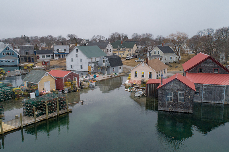
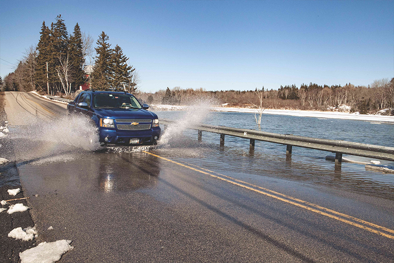
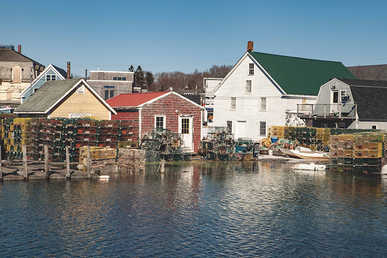
The heart of the community is Carver’s Harbor, home to a busy commercial port with more than 30 businesses along Main Street and 200-plus fishing boats in the water. Rising sea levels and flooding due to storms is a huge concern for residents and businesses alike. The community is taking action now, recently completing an assessment of the harbor area and coming up with options to make sure its community is resilient in the face of potentially drastic change.
Q & A WITH ANDY DORR, VINALHAVEN TOWN MANAGER
What got the ball rolling for Vinalhaven and what have been the island’s first steps?
When the flood maps of the National Flood Insurance Program were recently updated, that was the impetus for starting to ask questions. At the same time, students at the middle school were learning about global climate change. They applied what they were learning to their own community and made a presentation to the selectmen. It was kind of a nice, fun way to kick off the issue. From there, we created the sea level rise committee and we applied for and got a couple of grants.
How did you get volunteers for the sea level rise committee?
There were a handful of folks who were interested in the topic and a handful who understood how sea level rise would be an issue for Vinalhaven. They were willing to be on a committee to address the issue. The committee is full at this point. We have six members – one is a selectman.
What grants did you get and what have they done for the community?
The first one was the Maine Coastal Program Planning Grant. That was a big next step. The grant allowed us to work with Ransom Engineering to identify how and where, and maybe even when, we are at risk. That process took about a year-and-a-half.
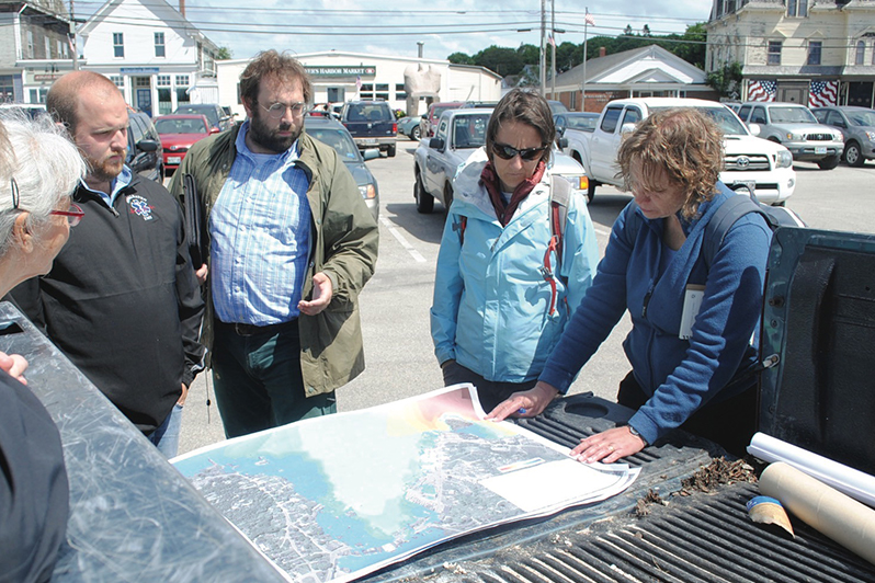
While we were working with Ransom, we got a technical assistance grant. A Design and Resiliency Team (DART) – an interdisciplinary team – came to the island for a weekend during which they hosted community charrettes and focus group discussions. They capped the weekend with a presentation showing us some visuals of what the water level would look like under different scenarios, like what the flood level would be in a 100-year storm situation, and how particular changes, such as elevating roadways, sidewalks and buildings, could help mitigate future flooding.
At the same time these grants came through, we were working on our downtown master plan. Because of that overlap, we had people starting to ask questions about sea level rise impacts during our downtown planning meetings. They wanted to understand the risks and what the community should be planning for infrastructure-wise based on those risks.
So, with information at hand from these grants, what are your next steps?
We’ve got a long list of things we’d like to do, so it’s about prioritizing those things. The first thing we’re going to be doing is the Maine Flood Resiliency Checklist. We’re working on that sometime this fall. It’s a good process in and of itself because it helps the community identify places to look at more specifically. It also could be used as a precursor for participating in the National Flood Insurance Program’s Community Rating System. Participating communities become more resilient as they meet various levels in the program and as communities meet those resiliency guidelines, flood insurance premiums for those with flood insurance are lowered. How much they are lowered depends on the degree of resiliency reached. This process requires a lot of time and at least a dedicated part-time staffer, so that’s a step we’ll be looking at as we go along.
In terms of the big infrastructure pieces, some of it is just part of natural lifecycle replacement. When you have to replace a bridge and you know it floods now, then it probably makes sense when it’s time to replace it to raise it. Part of what the Ransom grant did for us was to give us probability scenarios to help us figure out if we can get 60 or 70 years out of a new bridge raised to X level.
We also plan on reaching out to other communities in other areas – maybe even other parts of the world – that are ahead of us in dealing with or addressing this. There are a lot of places in Europe and even in the States that are making efforts to make significant changes to their infrastructure to mitigate or adapt to those rising risks. By looking to what others have done or are doing, we can learn: Is it working? How is it funded? Are people satisfied? And we can learn from things that didn’t work.
How are you engaging your community on this issue?
We don’t have a formal plan to engage the community, but it’s any means available to us. Sea level rise committee meetings and selectmen meetings. We put columns periodically in the local paper, The Wind, which detail the committee’s efforts. We put information out on social media – primarily Facebook – and on the town website. And we have binders of materials about the issue at various locations in the community, like coffeeshops.
What resources would you direct other communities to?
Call your neighboring towns and ask what they’re doing. There are some great listservs out there, too. The Island Institute and the state have good resources. The state has a good flood management program and mapping resources and some how-tos. Most communities have access to a regional planning commission. The Mid-coast Regional Planning Commission is making an effort to work with communities on sea level rise work. There’s funding from the state to help carry that out. So, that’s another resource communities should be looking at.
RESOURCES
- Island Institute’s Sea Level Rise Symposium Presentations
- A Climate of Change: Sea Level Rise
- Vinalhaven’s Sea Level Rise Committee Materials
- Maine Flood Resilience Checklist
- National Flood Insurance Program Community Rating System Information
- Maine Coastal Program Shore and Harbor Planning Grants
- Midcoast Regional Planning Commission
- Island Journal 2019, Coalition Building at the Water’s Edge
- Island Journal 2019, Resilience is the Response to Rising Waters
- Island Journal 2019, Whelmed in Key Largo
Originally Published June 2019
