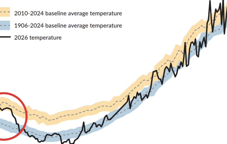
This Waypoints graphic shows data on drought, precipitation, and wildfires in Maine. The state has been experiencing drought since the summer of 2025, and this summer, with above average temperatures and below average precipitation, several coastal Maine counties moved from moderate to severe drought. Even more recently—after this graphic went to print—some of them moved to extreme drought.
Waypoints is part of Island Institute’s effort to gather data and share stories that spur action and provide decision-making support to community leaders. Like the waypoints on a journey or map, thoughtful interpretations of data and science provide navigation points toward community-led solutions.