
Waypoints: Community Indicators
Waypoints is part of Island Institute’s effort to gather data and share stories that spur action and provide decision-making support to community leaders. Like the waypoints on a journey or map, thoughtful interpretations of data and science provide navigation points toward community-led solutions.
WAYPOINTS: MAINE'S WORSENING DROUGHT
Resilience Indicators for Maine’s Coast and Islands
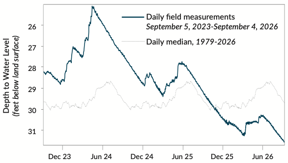
This Waypoints graphic shows data on drought, precipitation, and wildfires in Maine. The state has been experiencing drought since the summer of 2025, and this summer, with above average temperatures and below average precipitation, several coastal Maine counties moved from moderate to severe drought. Even more recently—after this graphic went to print—some of them moved to extreme drought.
WAYPOINTS: HOUSING AND AFFORDABILITY
Resilience Indicators for Maine’s Coast and Islands
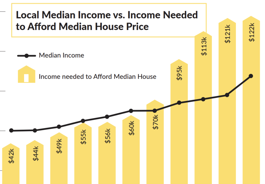
This Waypoints page looks at the state’s housing challenges through three different lenses: affordability, existing housing supply, and the need for new housing. There is much more demographic, income, and housing related data that can be found through various housing data portals. Some of this data can be viewed and compared at the county or community level.
WAYPOINTS: CHANGING AIR AND OCEAN TEMPERATURES
Resilience Indicators for Maine’s Coast and Islands
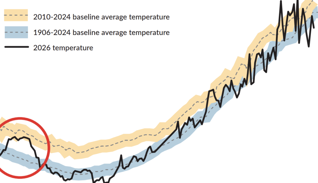
This Waypoints spread shows data on changing air temperatures in Maine and water temperatures in the Gulf of Maine. Air and ocean warming are driven by climate change. Changes in atmospheric and oceanic currents, like jet streams and the Gulf Stream, influence short-term events, like cold snaps or ocean cooling, but the long-term trend of warming remains.
WAYPOINTS: NAVIGATE
Resilience Indicators for Maine’s Coast and Islands
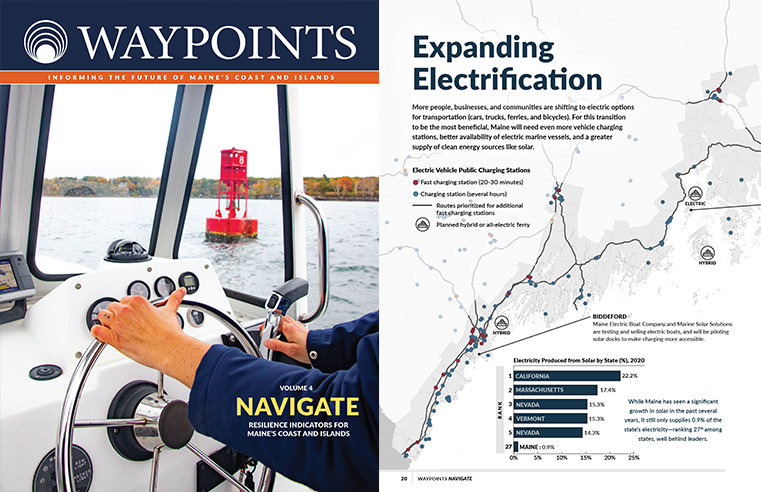
Waypoints: Navigate explores the systems that help communities along Maine’s coast and islands prepare for and thrive in the face of change. The data shared in this edition informs our understanding of how communities are grappling with social, environmental, and economic shifts to chart a course toward a resilient future.
Topics include a cost to income ratio, the housing market, critical infrastructure risk, community planning, expanding electrification, workforce training, and more.
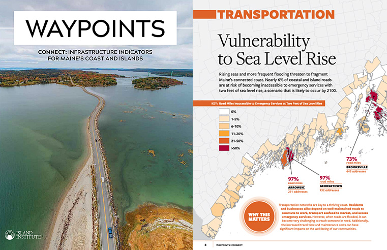
WAYPOINTS: CONNECT
Infrastructure Indicators for Maine’s Coast and Islands
Waypoints: Connect explores the status of Maine’s coastal infrastructure systems, with a focus on the topics where we see local and state leaders grappling with change. We looked at data that are central to our physical, economic, and civic infrastructure.
Topics include broadband, transportation, energy, trade, working waterfronts, and infrastructure.
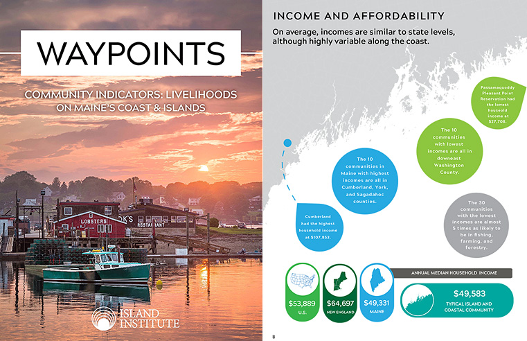
WAYPOINTS: LIVELIHOODS
Livelihoods on Maine’s Coast and Islands
Waypoints: Livelihoods is dedicated to quantifying the way coastal Mainers make a living and presents new data that tells the story of how income levels, prevalence of self-employment, impacts of fisheries, and seasonality of the labor force define the economic and cultural landscape of our region.
Detailed sections look at data on Maine’s coastal and island industries, income and affordability, business ownership, labor force and seasonality, self-employment, the lobster fishery, age and education, and gender in the workforce.
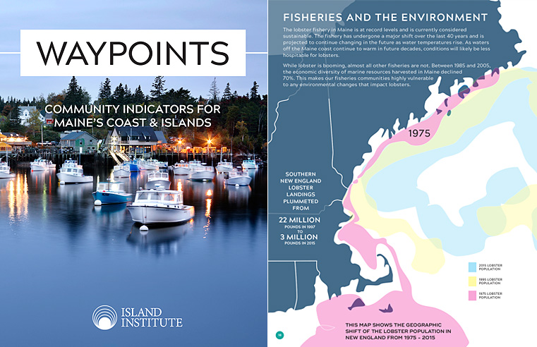
WAYPOINTS:
COMMUNITY INDICATORS
Community Indicators for Maine’s Coast and Islands
Waypoints: Community Indicators is the first edition of the series that was published as a response to the requests from community members who needed access to clear, accurate, data to meet local needs for planning and decision-making. It provides information about local economies, demographics, and the environment of Maine’s coastal and island communities.
Topics include self-employment, the economic impact of Maine lobster and fisheries, broadband accessibility, energy and home heating, housing, fisheries and the environment, and sea level rise.