BACKGROUND
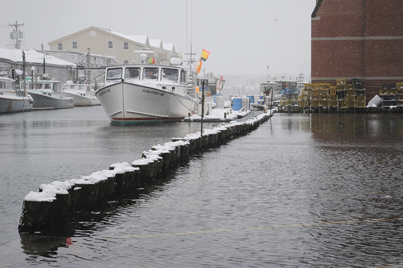
Portland, the state’s largest city, is and always has been intimately connected to water. As the largest tonnage seaport in New England, its deep water harbor attracts commercial vessels from all over the world – as well as recreational boats of all stripes, from sailboats to kayaks.
And today, as in previous centuries, its waterfront area downtown has been its economic and cultural center. Fishing, maritime activities, the arts, shopping, recreation, food and dining, and tourism – everyone comes to and depends on the city’s downtown waterfront.
As much as the water is a beloved by residents and visitors alike, it also poses a serious risk to the city. Nuisance flooding along Commercial Street bordering the waterfront and in Bayside has come to be expected and accepted.
A 2013 sea level rise impact report by the Casco Bay Estuary Partnership estimated that with one foot of sea level rise, Portland’s nuisance flooding intensifies, especially with tidal inundation. With three-feet of sea level rise, though, water has more serious impacts, including tidal inundation of nearly every wharf and pier along Commercial Street and roads and buildings in Bayside and in the Back Cove would be overwhelmed.
The city got a taste of what could come on September 30, 2015, says Bill Needelman, the city’s waterfront coordinator, when significant rain in the middle of the day coincided with astronomical high tides. Four inches of rain an hour and an 11.5-foot tide at noon resulted in three feet of water in Bayside – with some places topping out at five feet. It was a shocking wake-up call for city leaders and residents, who have been trying to slowly address sea level rise and storm surge ever since.
Q & A WITH BILL NEEDELMAN, PORTLAND’S WATERFRONT COORDINATOR
What happened after the Sept. 30th event?
We now have flood response protocols in place that were not in place prior to September 30, 2015. Following that, we instituted flood response protocols. Now fire, police, emergency management, public works, and the city’s communication director all have protocols in place for communicating with the public, and communicating within each departmental response to barricade roads and keep people from making bad decisions – like driving into flooded areas – in the condition of more water.
When we know that storms are predicted, the protocol suggests going out and doing proactive maintenance – checking the catch basins and the storm water in-takes – pre-deploying barricade assets so that it’s quicker. And we have an assigned staffer who serves as an emergency services coordinator who takes the lead in the response.
Does the city have or is it working on a specific plan to deal with sea level rise and storm surge?
There is no big, sweeping plan. That is a future step.
But clearly you’re making some steps.
With the protocols in place, we’re doing a better job of accommodating water – both in terms of keeping city infrastructure functioning and keeping the public from making bad choices.
The other step we’ve taken is in the Bayside neighborhood. We engaged in a process called Bayside Adapts, where we hired engineering firm Woodard & Curran. They helped us understand what kind of engineering information is necessary prior to making large-scale decisions. They were able to tell us where we need better pipe information and better topographic information, for example – where the missing pieces of data are.
Bayside Adapts also helped establish our expectations for sea level rise and translate those expectations into the city engineering framework. So, for example, if we look at a scenario of the next 50 years in a particular area of the city, we can see that water is at 7.3 feet now will go to 9.3 feet and what would we need to do, infrastructure-wise, to accommodate that rise.
We’re also partnering with South Portland on a climate mitigation process. That’s in its early days, but it will help us evaluate adaptation opportunities in a coordinated fashion.
How are you engaging the public?
With the Bayside Adapt process, we asked the architectural and design communities to visualize what Bayside would look like under conditions of more water. We got some great visuals and some great thinking on some of the both smaller scale and larger scale improvements that could take place.
Probably the biggest takeaway that I received from it is that is that there’s a perception right now that development in flood-prone areas is risky and is likely to make our community more vulnerable. But there’s an alternative scenario where adaptation takes place through the mechanism of development. It’s only at that point where people are making large-scale investments that you have the opportunity to change the world in a way that makes you more resilient and safer in the condition of more water.
The other thing we’re doing is participating in the High Water Marks Project, which is a federally-driving program. It documents historic flooding events by placing visual markers on site to show where water has come in the past. We’re taking it a step further, though. Alongside the historic water level markers we’re placing markers that will show high and low scenarios for sea level rise.
If you had to predict what the waterfront in Portland will look like in 50 years with corresponding sea level rise, what would you say?
I think that we may find ourselves 50 years from now gaining back some of that working waterfront that has been lost because the working waterfront uses and industries are just going to be better prepared to deal with that uncertainty than other uses.
Think about how many industries on the waterfronts work off of floats and floating infrastructure. A lot of them. I think floating infrastructure is going to be part of the solution moving forward. It’s adaptive, it’s flexible, you can move it if you need to and it adjusts to sea level rise quite well. You have to build that land-side interface, but flooding infrastructure is something that fisheries and marine construction and marine transportation already utilize. Residential construction, hotels and other things will have a harder time because they’re not as flexible.
We are not prepared to make the big move. It’s all bad news and it all costs money. But, we’ve got to learn to talk about it so we can make decisions. In the meantime, we’re going to accommodate the water as best we can and do a better job of getting wet.
RESOURCES
- Bayside Adapts Design Challenge
- Sea Level Rise and Casco Bay’s Wetlands Report
- Island Institute’s Sea Level Rise Symposium Presentations
- National Flood Insurance Community Rating System information
- Maine Coastal Program Shore and Harbor Planning Grants
- High Water Mark Initiative
- Island Journal 2019, Coalition Building at the Water’s Edge
- Island Journal 2019, Resilience is the Response to Rising Waters
- Island Journal 2019, Whelmed in Key Largo
Originally Published June 2019
