Calling Your Bluff Toolkit
A Resource for Understanding and Responding to Shoreline Change
Developed by the Great Diamond Island Sea Level Rise Partnership (GDI Partnership) alongside islanders from Long, Chebeague, and Little Diamond Islands, and in collaboration with Island Institute.
Partners & Support
When engaged citizens come together—driven by a shared concern for climate change—they can be a powerful force for progress. Building partnerships with local officials, organizations, and regional experts is key to advancing meaningful resilience work.
Create Coalitions

By uniting citizens who share concerns about climate change and a commitment to protecting their shoreline:
• Build diverse partnerships. Connect with local officials, organizations, and regional experts.
• Take on high-impact projects. Organize dune restoration, plant living shorelines, map and document vulnerable areas, or host resilience-planning workshops. These projects generate valuable data, designs, and momentum that can help municipalities build upon.
Work with Municipalities

With limited capacity to plan for shoreline erosion and heavy reliance on volunteers, many coastal municipalities depend on citizen-led action to drive progress:
• Identify municipal needs. Determine where local capacity is stretched—such as shoreline assessments, public engagement, or grant applications.
• Align your projects with those needs. Select initiatives that address those gaps—such as dune restoration, living shoreline projects, or documenting flood-risk areas.
• Provide useful information. Data, visuals, designs, or reports municipalities can apply immediately to planning and funding opportunities.
Finding Partners

Nonprofits and state agencies play complementary roles in building community resilience. Partnering with them brings expertise, resources, and credibility that local leaders may not access alone. They can provide capacity by organizing meetings, providing staff support, and managing flexible grants. State agencies like the Maine Geological Survey (MGS) and Maine Department of Environmental Protection (DEP) set the broader framework, offering funding, data, and policy guidance. Patience is key. These partnerships may move slowly but create stability and help align communities with statewide funding and protection goals.
Community Volunteering

When engaged citizens come together—driven by a shared concern for climate change and a commitment to protecting their community and shoreline—they can be a powerful force for progress. Building partnerships with these individuals, along with local officials, organizations, and regional experts, is key to advancing meaningful resilience work.
Volunteerism is a driving force behind many communities. Engaging residents in roles such as organizing events, coordinating projects, documenting shoreline changes, and sharing knowledge strengthens participation and builds local capacity. Volunteer-driven efforts bring added benefits:
• Increased community buy-in and awareness of coastal issues
• Strong neighbor-to-neighbor networks and future collaborations
• Long-term ownership of coastal restoration projects.
Did You Know?
Grantmakers in Maine—both at the state level and among private foundations—tend to prioritize funding projects that demonstrate broad benefit. Proposals that involve partnerships across communities, organizations, or islands are more likely to receive support, as they show shared commitment, greater impact, and efficient use of resources. The more stakeholders a project serves, the more compelling it becomes for potential funders.
Learning Together
Working regionally multiplies impact—helping communities secure more funding and attract state and federal support. By joining forces with neighboring towns, you can share resources, strengthen grant applications, and access expertise from agencies such as the DEP and the Maine Geological Survey. Nonprofits can facilitate these efforts and make shared learning events possible that no single community could host alone.
Local to Regional

In communities, when volunteers lack support from local officials or when municipal capacity is limited, progress often depends on seeking guidance elsewhere. Partnering with regional and nonprofit organizations provides the structure and momentum to move local efforts forward—broadening participation, reconnecting local leaders, and laying the groundwork for lasting collaboration.
Identify Knowledge Gaps

Start by identifying what your community understands—and what it doesn’t. For example, many residents see erosion but don’t realize that hard armoring can cause end-effect erosion—worsening damage to neighboring shorelines. Host simple webinars with experts using local examples to make science relatable. These conversations build understanding and drive action.
Go Big

With the network of experts you are cultivating, you have the foundation to create a meaningful event that deepens understanding and strengthens community ties. Don’t hesitate to scale up—larger events can spark ideas, partnerships, and action. These community events can create momentum, leading to joint grant applications, pilot projects like living shorelines, and stronger partnerships with state agencies. Keep track of what worked and what didn’t to guide future events.
Local Data
Collecting local data is a critical step toward resilience—this section offers tools and guidelines for documenting your property, from bluff surveys to drone imagery tips, to help you track and understand coastal change over time.
Did You Know?
The Maine Geological Survey equips coastal property owners with tools, maps, and guidance to address the growing risks of erosion, worsened by higher seas and higher storm surge. Resources include bluff stability and living shorelines suitability maps, sea level rise tracking tools, living shoreline case studies, and model ordinances. MGS also partners with communities and residents to monitor shoreline change, helping property owners plan for and adapt to a shifting coast.
Shoreline Surveying with MGS

Local groups can play a vital role in helping MGS update coastal hazard maps—not only in unstable areas, but anywhere landowners seek clarification or a revised bluff designation. By organizing on-water access and supporting shoreline documentation, these efforts help MGS geologists collect critical data more efficiently. Along with geotagged photos, this work tracks coastal changes and strengthens the maps that guide resilience planning across the state.
Did You Know?
The Maine Geological Survey equips coastal property owners with tools, maps, and guidance to address the growing risks of erosion, worsened by higher seas and higher storm tides. Resources include bluff stability and living shorelines suitability maps, sea level rise tracking tools, living shoreline case studies, and model ordinances. MGS also partners with communities and residents to monitor shoreline change, helping property owners plan for and adapt to a shifting coast.
Drones
Drones have transformed coastal monitoring, offering an accessible, cost-effective way to capture high-resolution shoreline data. Even consumer drones can detect bluff retreat, dune shifts, and vegetation changes.
Did You Know?
Studies show drone imagery can cut monitoring costs by up to 80% compared to traditional methods. This 7-page photo guide, also found in the resource section, provides essential tips and monitoring guidelines for property owners and community groups to track shoreline changes and better understand erosion over time.
Monitoring Bluff Erosion with a Smart Device

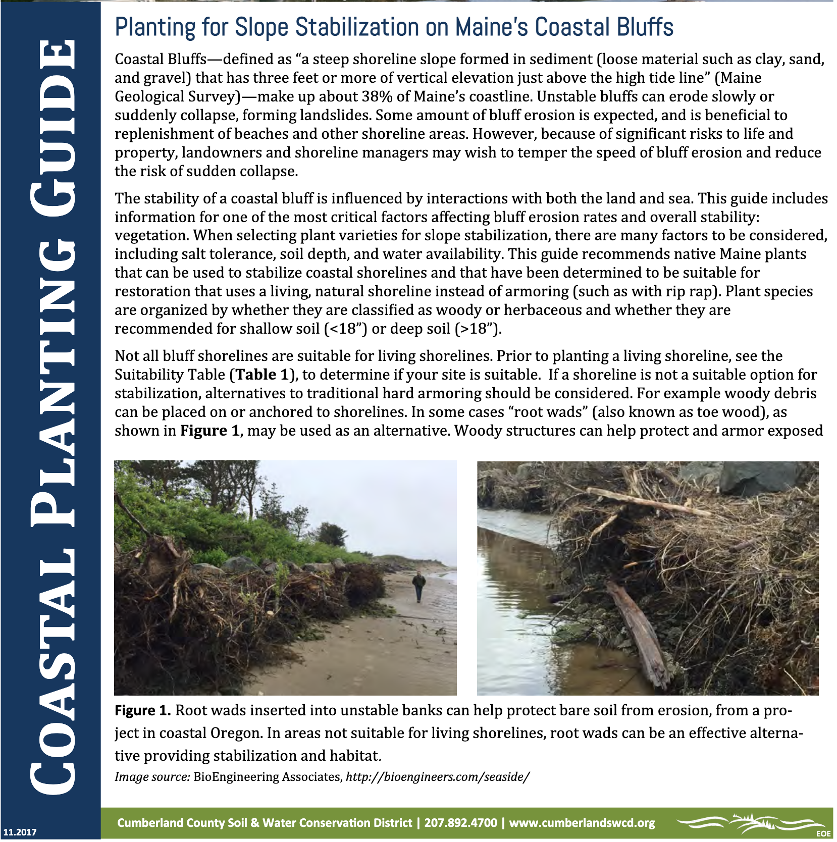
You can help Maine geologists monitor bluff erosion using your smartphone or a GPS-enabled camera. The built-in GPS tags each photo with its location, allowing MGS to use your images to update the Maine Coastal Bluffs and Landslides Map. At sites like this one, tracking erosion—especially at the end of riprap installations—can reveal bluff retreat rates and show how hard armoring can exacerbate erosion rates on neighboring properties. Photos documenting coastal erosion are also required to apply for most shoreline stabilization permits from the DEP.
Step By Step Site Photography

Make sure your device is set to capture GPS data. Define your shoreline boundary at low tide: pick a section of shoreline, include an item or person for scale.
Take two sets of photos: one on the upland (bluff top) and one at the intertidal zone for a minimum of 10 all.
Take multiple photos with each set:
- From the boundary ends near the toe and aimed toward the center.
- Take centered shots and photos that include springs, icicles, and runnels.
- Repeat set on upland to show lawn, bluff edge, and land management.
Submit photos to MGS. Your images will help update MGS maps to reflect the shoreline changes and its stability.
Did You Know?
Photos taken in early spring, late fall, or after major storms capture shifts in the landscape that strengthen hazard maps, inform statewide resilience planning, and support local efforts to prepare for future impacts.
Funding is Critical
Funding is essential and competitive. Successful grant applications don’t happen overnight. Here are a few lessons we’ve learned that can help you prepare.
• Build Partnerships and Design for Impact. Collaborate with nearby communities or organizations—regional efforts are more competitive. Create projects that are scalable and transferable to show broader relevance.
• Secure a Fiscal Agent. If you're not a municipality or nonprofit, find a partner who can legally receive funds.
• Prep Early. Draft a basic project description now—you can adapt it later as deadlines approach.
• Know What to Expect. Most grants ask for a clear description, alignment with public goals, defined tasks, and a realistic budget.
• Think Ahead (8–24 months out). Use a “crystal ball” approach—anticipate your future funding needs and be ready with ideas before opportunities arise.
Resources & Guides
Want to learn more? Click any image to explore related resources.
Mapping Tools
Coastal Bluffs & Landslide Maps
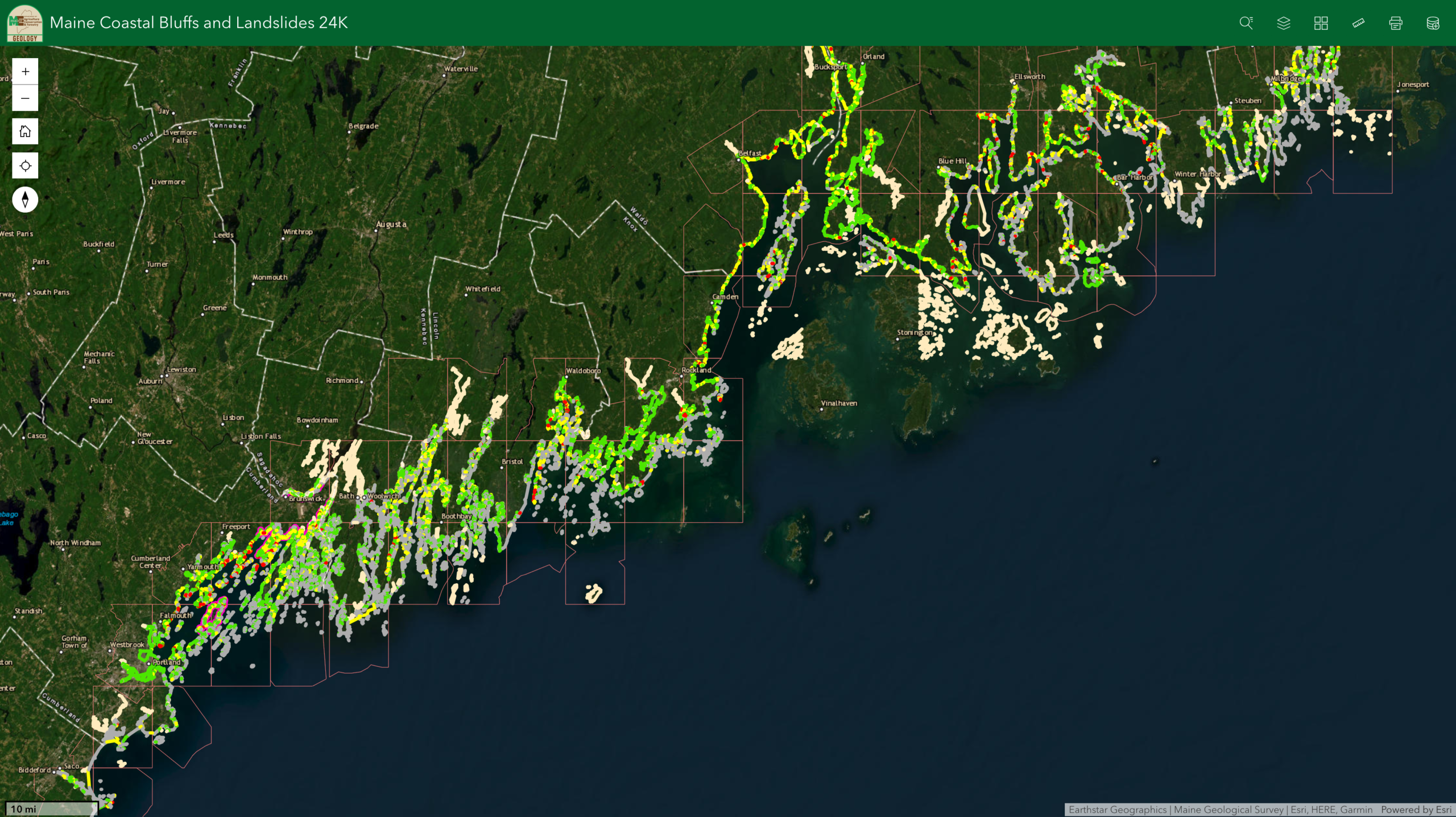
Digital maps that classify coastal bluffs by stability, shoreline type, and landslide risk to support planning and erosion management.
Source: Maine Geological SurveyLiving Shorelines Tool
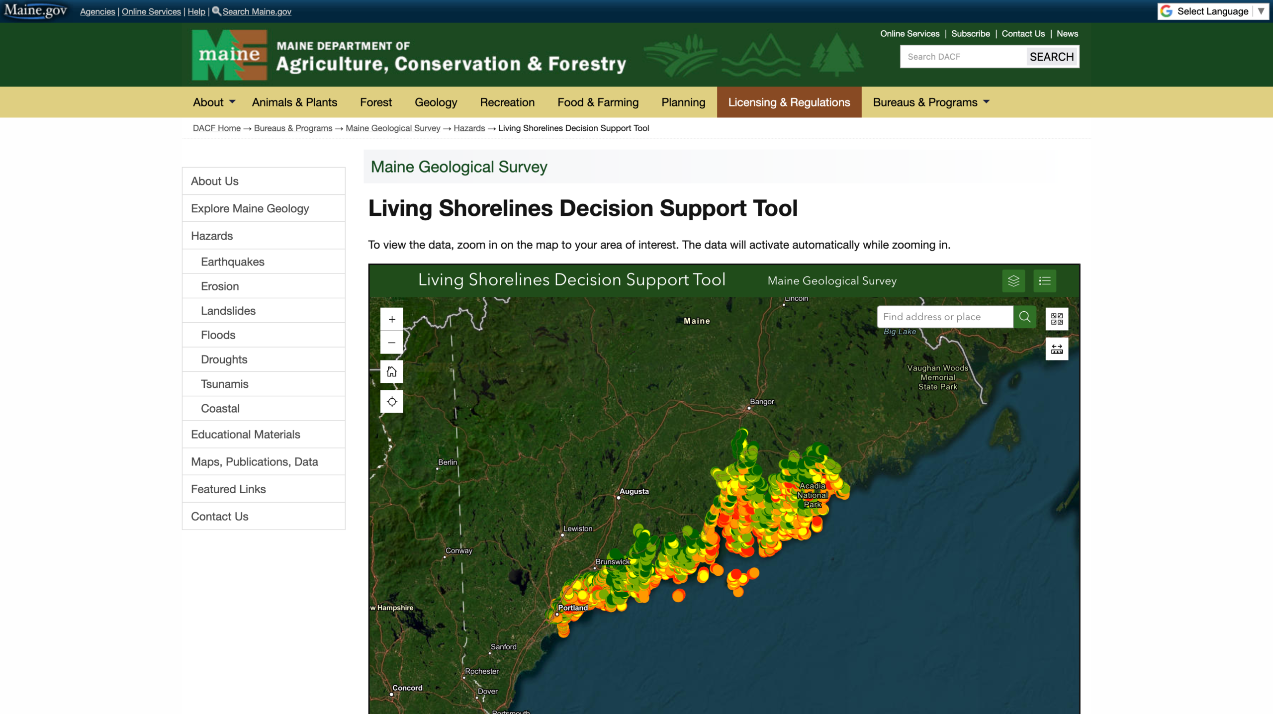
Maps shorelines based on suitability for nature-based mitigation (wave energy, slope, etc.).
Source: Maine Geological SurveyMaine Flood Hazard Map
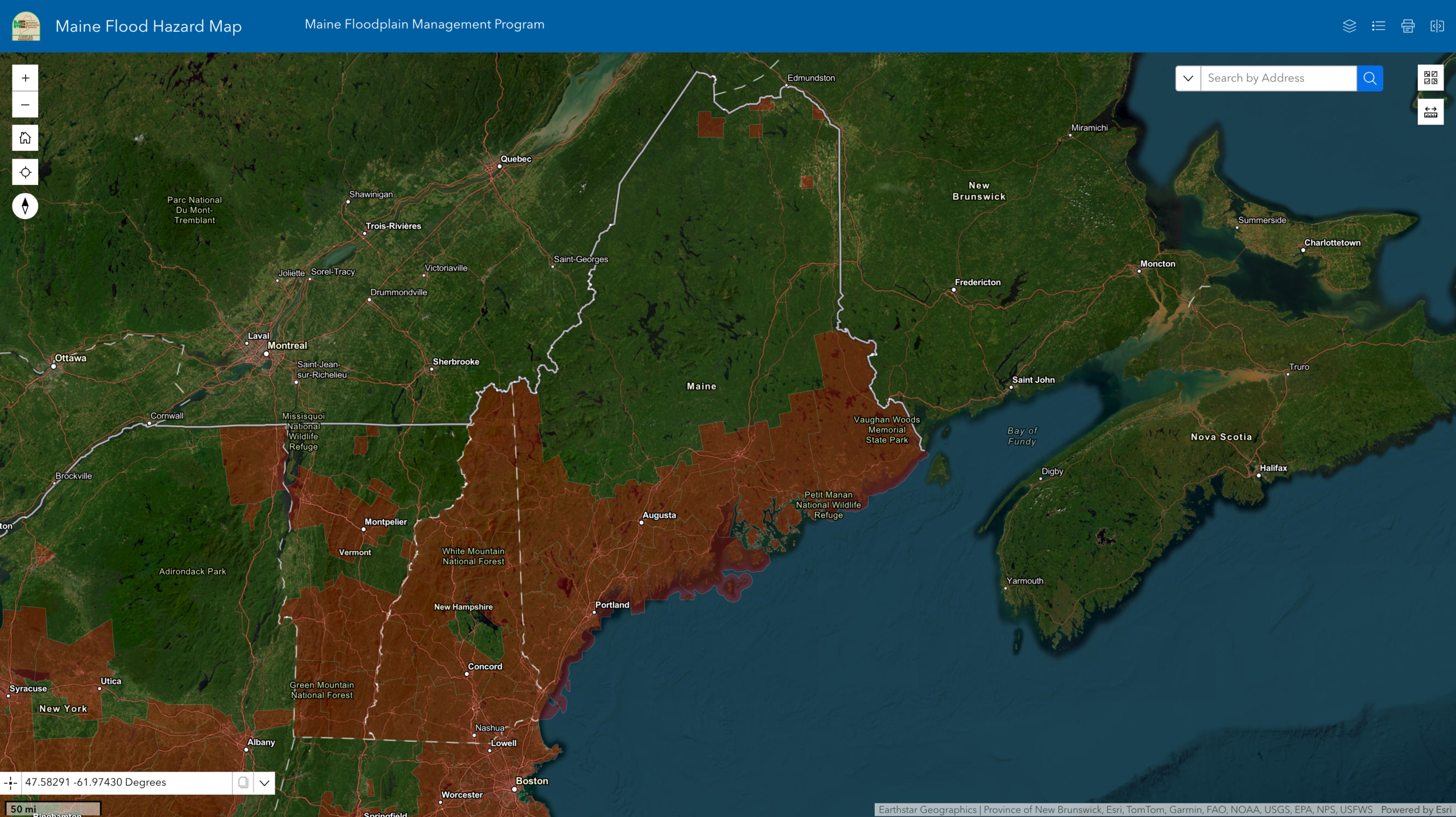
This interactive tool shows current and historical FEMA flood zones to support planning, permitting, and risk assessment across the state.
Source: Maine Geological SurveySea Level Rise and Storm Surge Scenarios
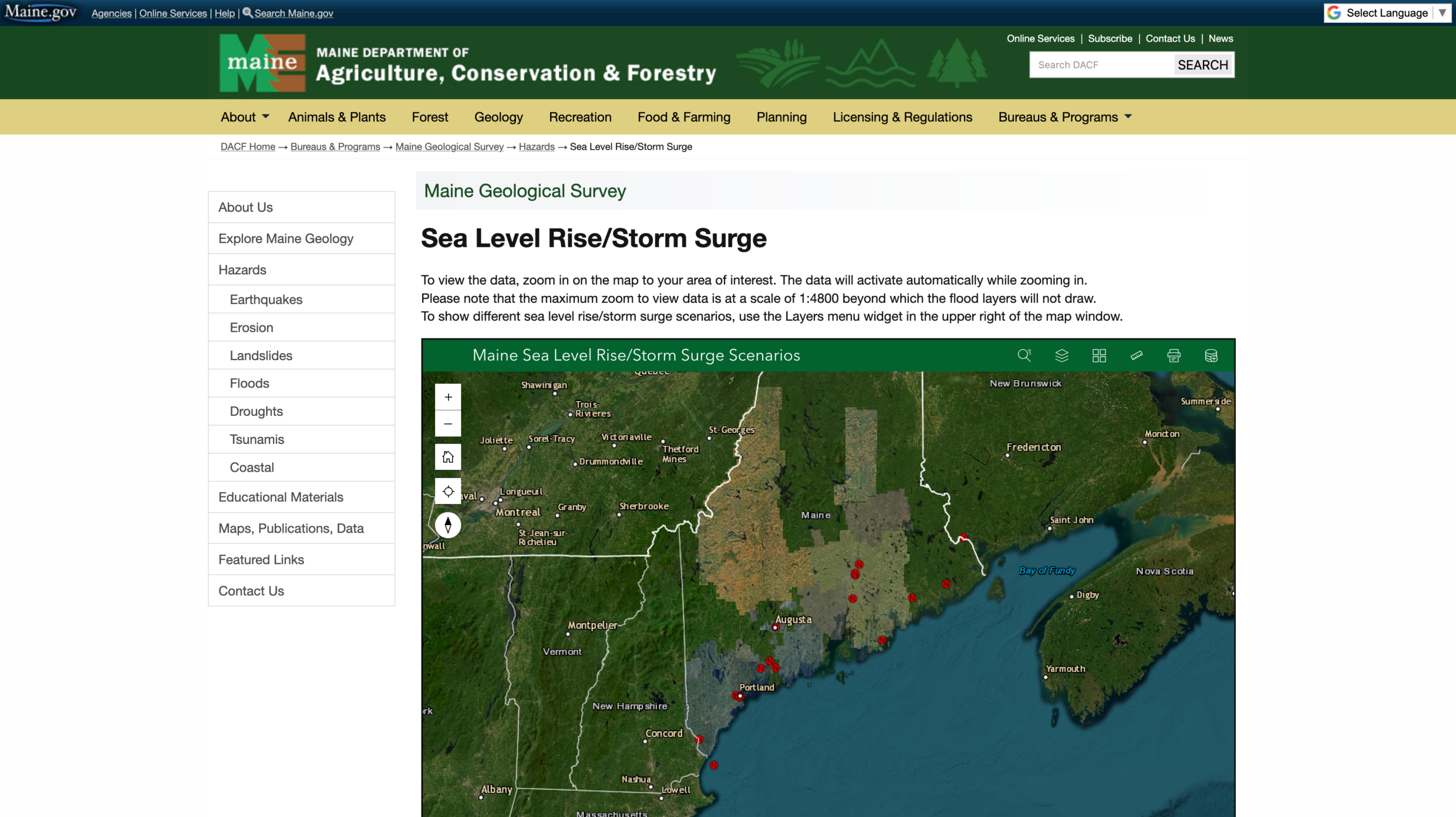
A tool to help property owners and communities assess vulnerability to storm surge and sea level rise and support informed community planning.
Source: Maine Geological SurveyGuides for citizens
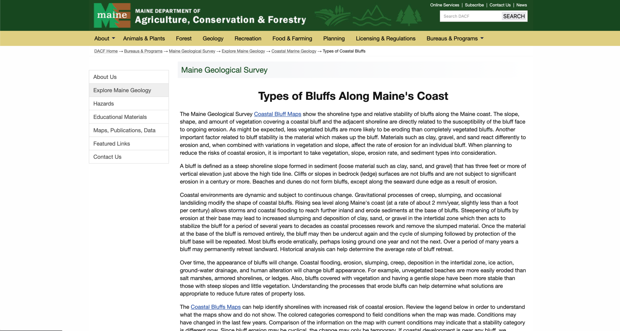
Types of Bluffs Along Maine's Coast
This page highlights Maine’s expanding use of nature-based solutions for erosion and features case studies that strengthen coastal resilience.
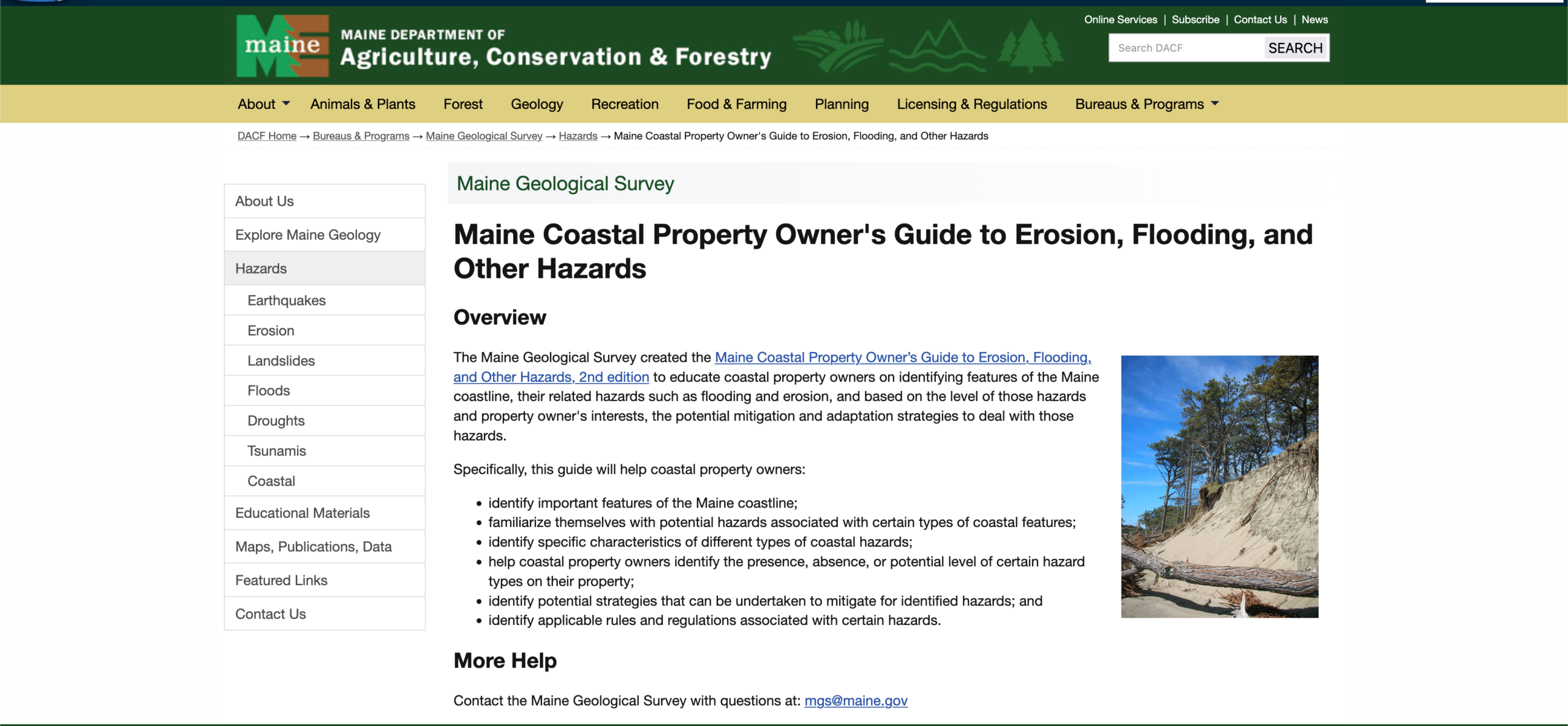
Source: Maine Geological SurveyCoastal Property Owner's Guide
This guide helps property owners identify coastal features, understand risks like flooding and erosion, and find strategies to protect their property.
Source: Maine Geological SurveyLiving Shorelines in Maine
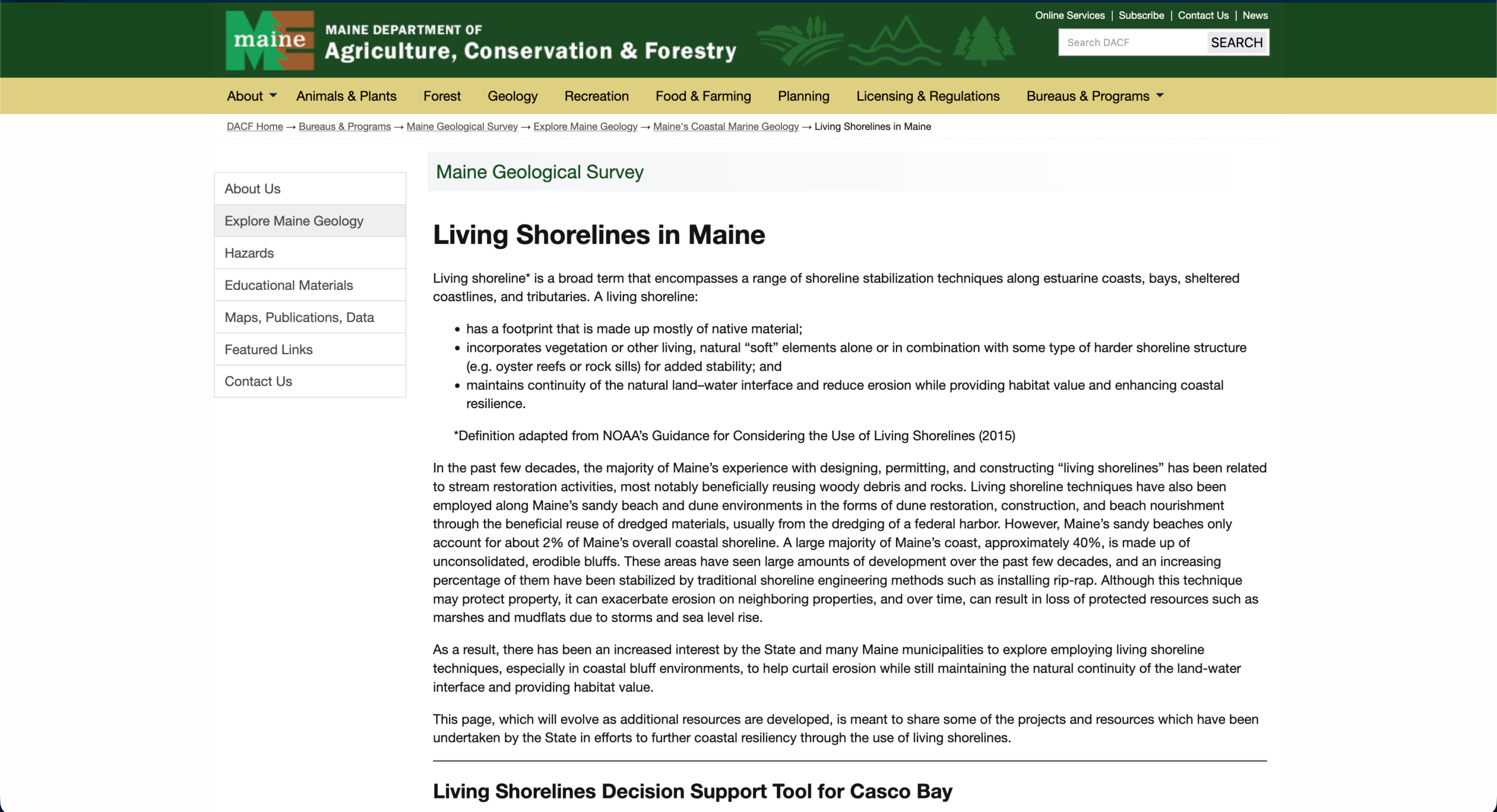
This page highlights Maine’s growing efforts to use nature-based solutions to address erosion, and showcases case studies that support coastal resilience.
Source: Maine Geological SurveyCumberland County Coastal Bluff Guide
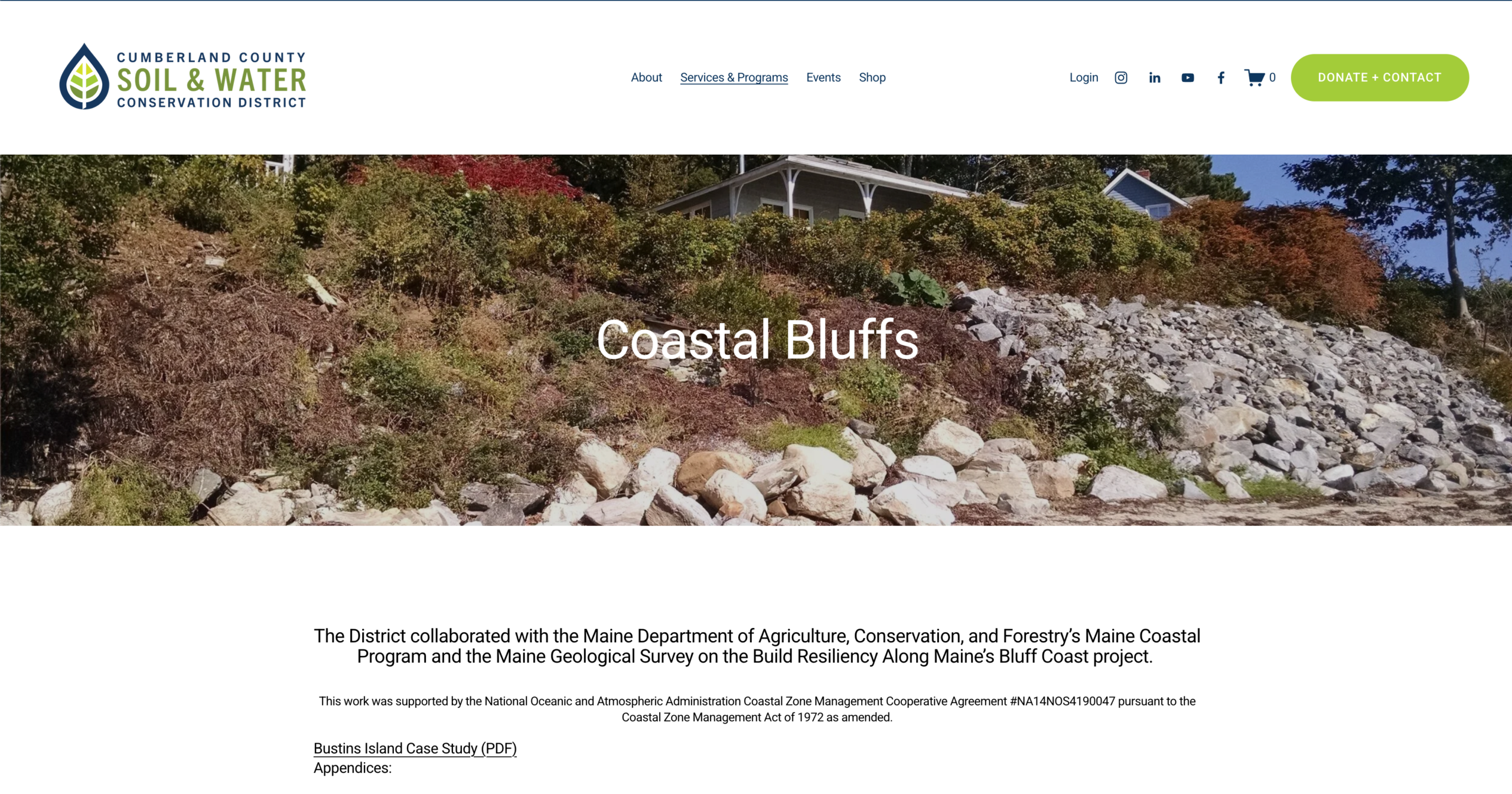
This coastal bluff toolkit offers tools, designs, case studies and guidelines to help address bluff erosion and build resilience.
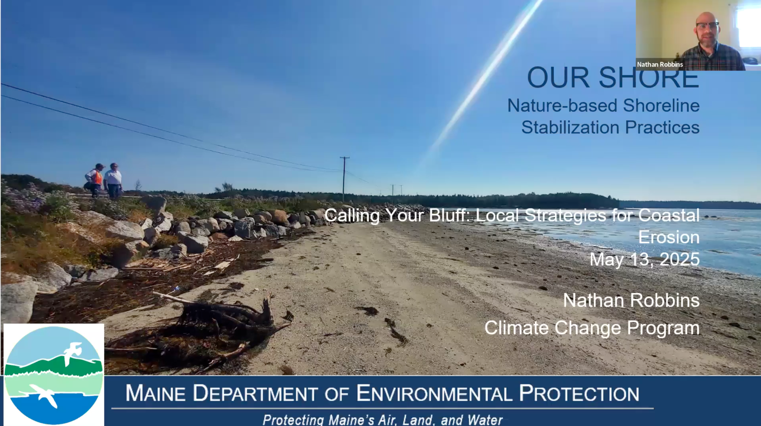
Source: Cumberland County Soil & Water Conservation DistrictOUR SHORE Program
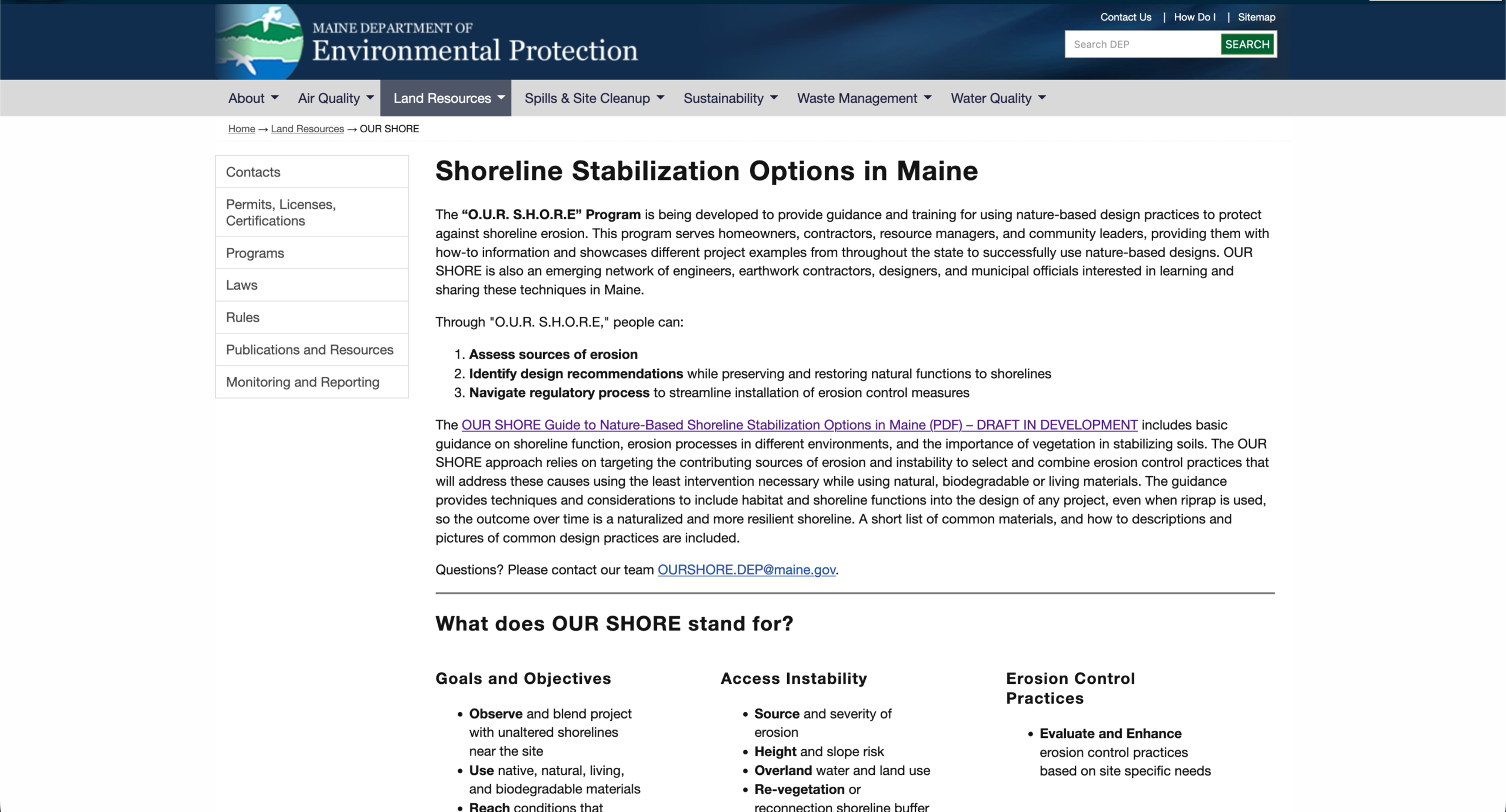
This site offers tools and examples to help homeowners, professionals, and communities use nature-based solutions to reduce erosion and share knowledge.
Source: Maine Department of Environmental ProtectionLiving Shorelines in New England
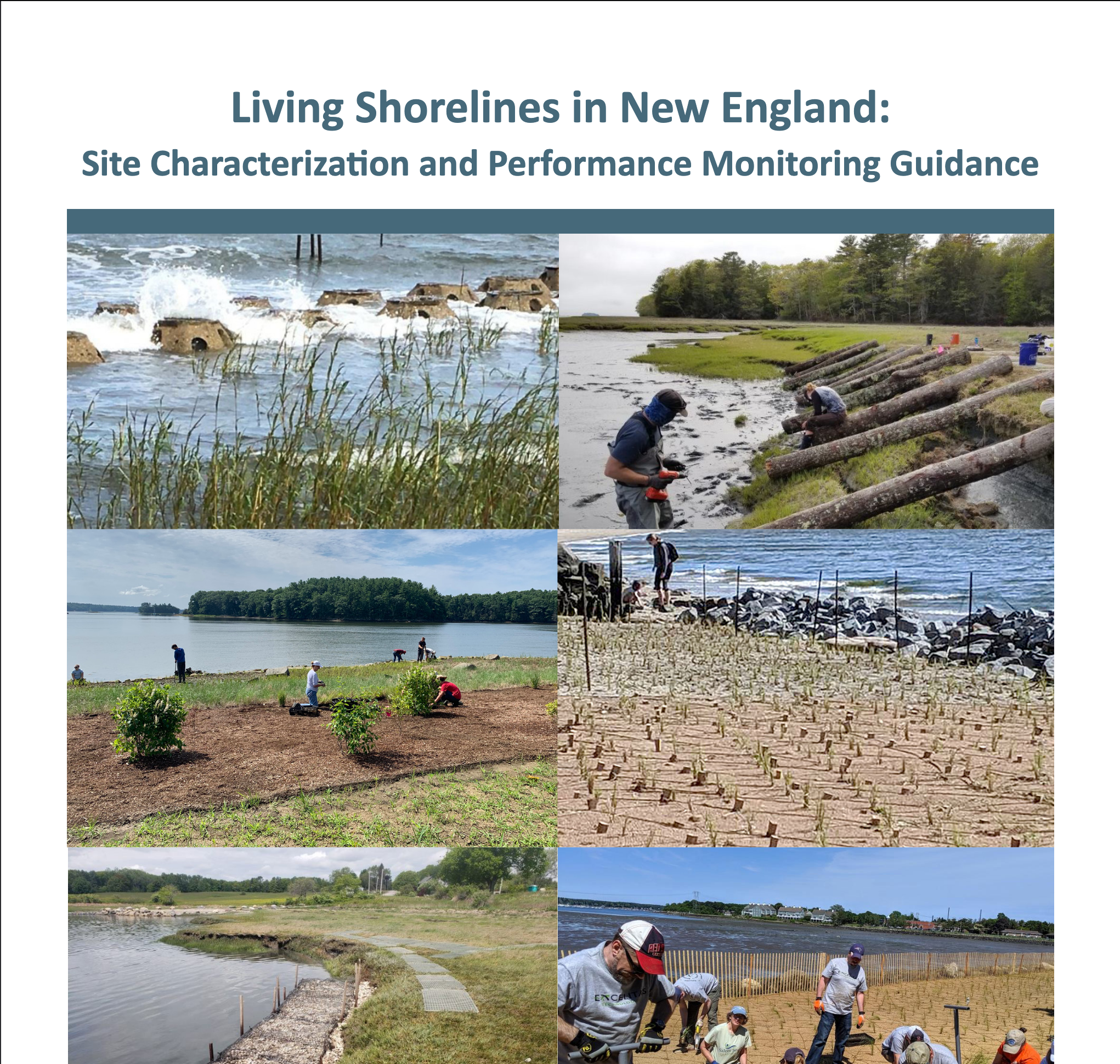
This PDF document provides tier one guidelines for training volunteers in simple, low-cost methods to monitor shoreline erosion.
Source: Northeast Regional Ocean CouncilDrone Imaging Guide
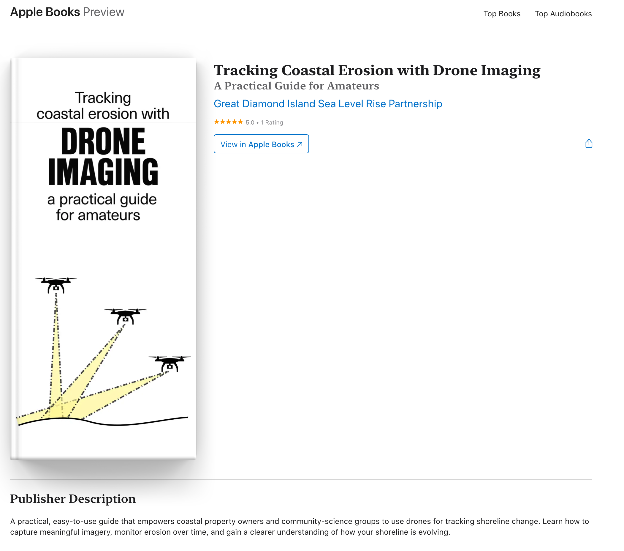
This interactive go-to drone imaging guide for property owners and communities to document and track changes along our coastlines.
Source: Great Diamond Island Sea Level Rise PartnershipPeaks Island Shoreline Vegetation Guide
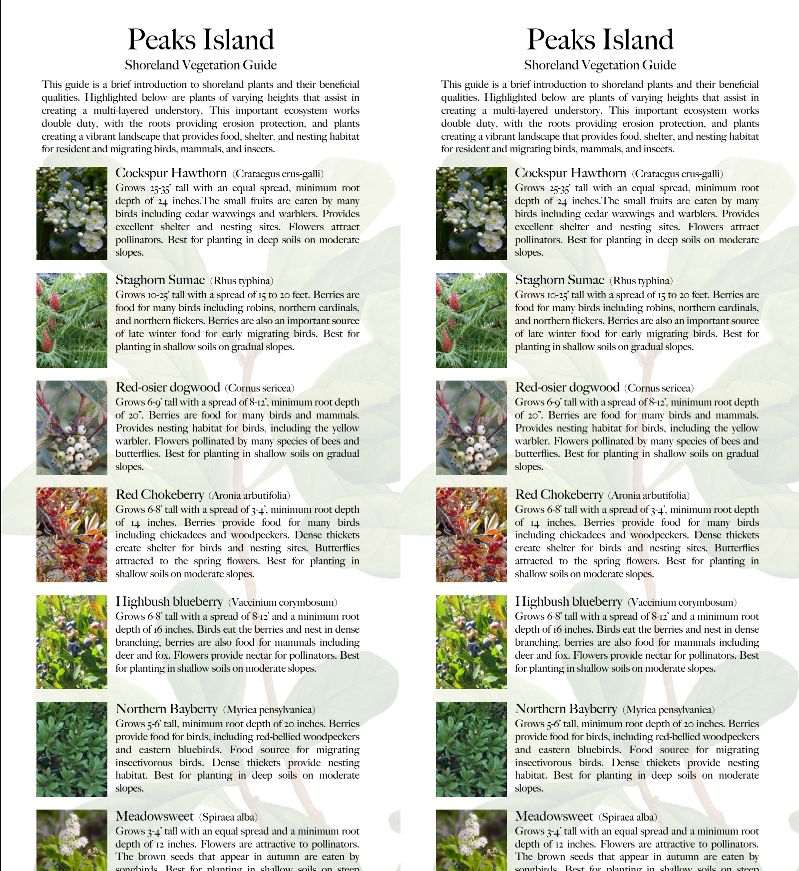
For the Casco Bay region, this PDF builds on the Coastal Planting Guide by highlighting species that are better adapted to these islands.
Source: Peaks Island Council Housing & Zoning CommitteeCoastal Planting Guide
This PDF is widely recognized as the go-to resource for coastal planting in Maine, offering practical guidance on using native vegetation to stabilize bluffs and strengthen shoreline resilience.
Source: Cumberland County Soil and Water Conservation DistrictOUR SHORE Guide
This pdf guide includes basic guidance on shoreline function, erosion processes in different environments, and the importance of vegetation in stabilizing soils.
Source: Maine Department of Environmental ProtectionCalling Your Bluff Videos

The Anatomy and Life Cycle of Coastal Bluffs
This webinar dives into shoreline classifications and the forces shaping coastal erosion—essential viewing for anyone managing shoreline change.
Source: Great Diamond Island Sea Level Rise Partnership
Local Strategies for Coastal Erosion
This webinar explores case studies from four Casco Bay islands, featuring discussions on regulations, resilience strategies, and community needs.
Source: Great Diamond Island Sea Level Rise Partnership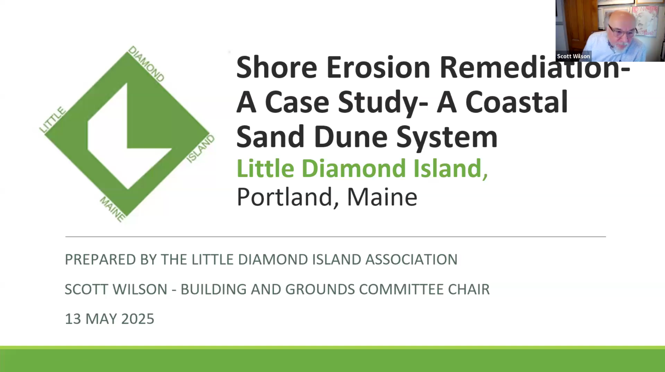
CASE STUDY 1: Erosion Remediation — A Coastal Sand Dune System
Little Diamond Island completed a hybrid shoreline project combining riprap bluff stabilization with a living sand dune. Volunteers built the dune, contributing $26K in labor savings while contractors handled the heavy work.
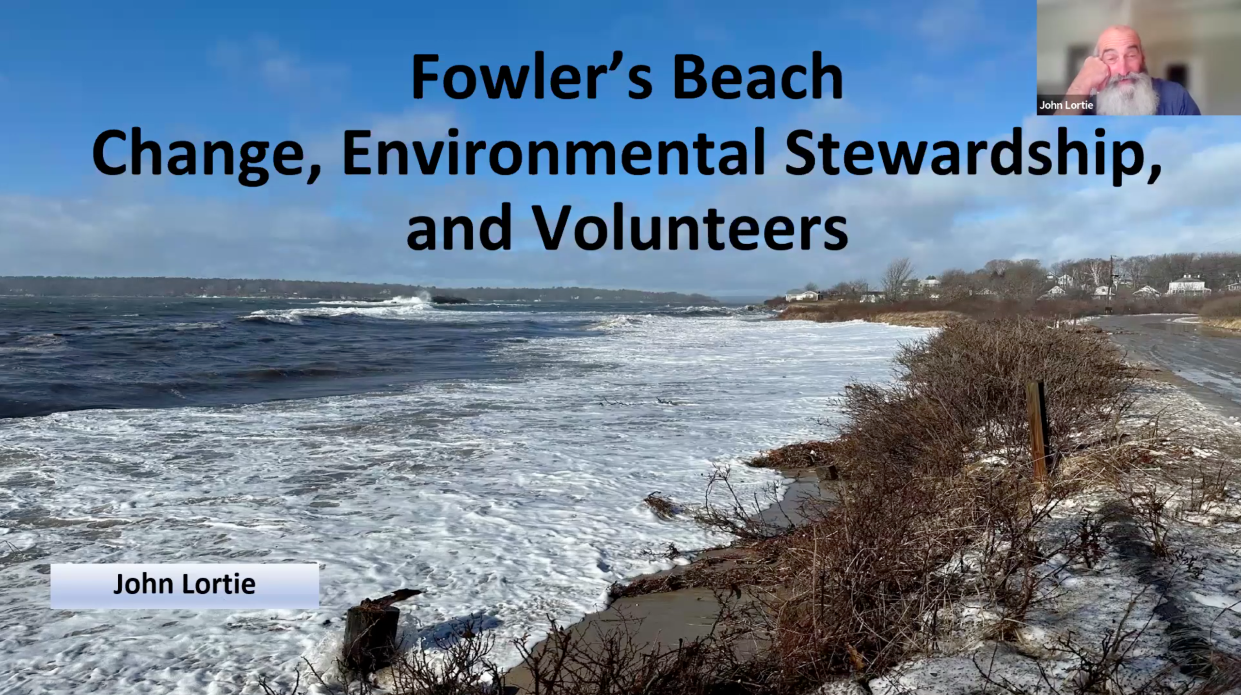
CASE STUDY 2: Stewardship at Fowler’s Beach on Long Island
Fowler’s Beach has seen 40 years of community stewardship, with residents documenting shoreline changes and using volunteer efforts to maintain and rebuild the dune system as natural defenses against ongoing erosion.
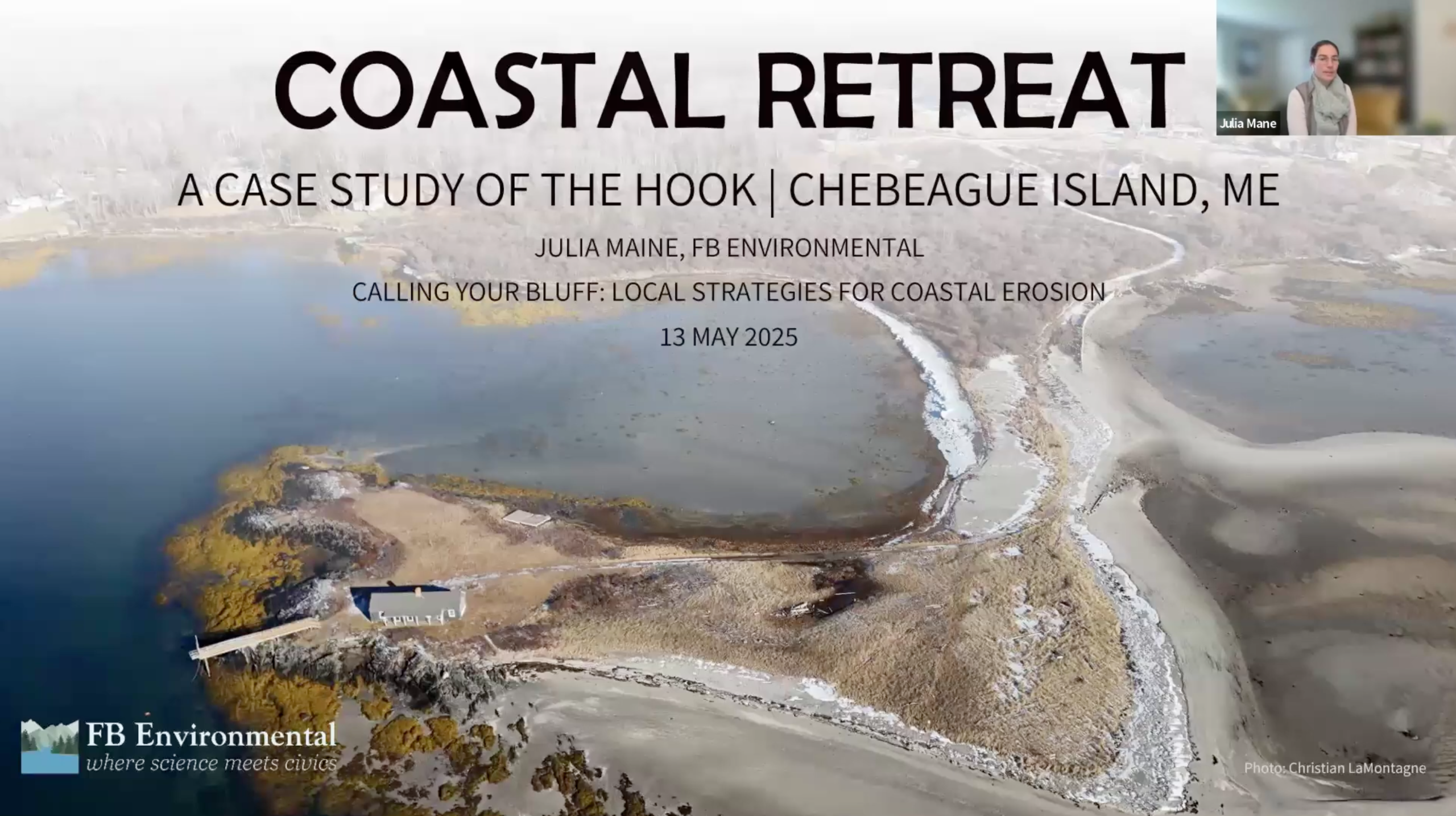
CASE STUDY 3: Coastal Retreat on Chebeague Island
At the Hook Site, this community chose retreat as its shoreline strategy. After weighing options, the community undertook a process that led to stepping back from the coast, highlighting retreat as a viable resilience pathway.
CASE STUDY 4: Evaluating for Nature-Based Stabilization
At Great Diamond Island, this site shows how the OURSHORE Program can guide stabilization with minimal intervention, allowing the shoreline to recover quickly—an advantage against sea level rise and erosion, and key to long-term stability and water quality.

Calling Your Bluff Symposium
Experts discuss the best ways to protect coastal bluffs in Maine from erosion, held at the Gulf of Maine Research Institute July 23, 2024.
Source: Great Diamond Island Sea Level Rise Partnership
Coastal Bluffs Features and Process
Peter Slovinsky, MGS. The science behind coastal erosion and data on the causes of our higher seas and changing shorelines.

Bluff Protection — From Design to Practice
Dan Bannon, GEI Consultants. Best practices for mitigating coastal erosion.

Coastal Retreat — A case study of The Hook on Chebeague Island
Julia Maine, FB Environmental. Learn how a community's decision to retreat from a site experiencing ongoing erosion.

Financing strategies for mitigating bluff erosion
Nikki Yanok, GMRI. Explore how organizations approach funding for coastal erosion projects.

Maine's permitting process and assessing solutions
Alison Sirios, Maine DEP and Nathan Robbins, Maine DEP. THE OUR SHORE PROGRAM: DEP requirements and new programs.

The Science of Hope:
Suzie Arnold, Island Institute. The science behind creating action and progress in tackling climate issues that seem unattainable.

Resilience
Gayle Bowness, GMRI. Creating resilience in your community.
Climate Data and Trends
The Data on Sea Level Heights in Maine
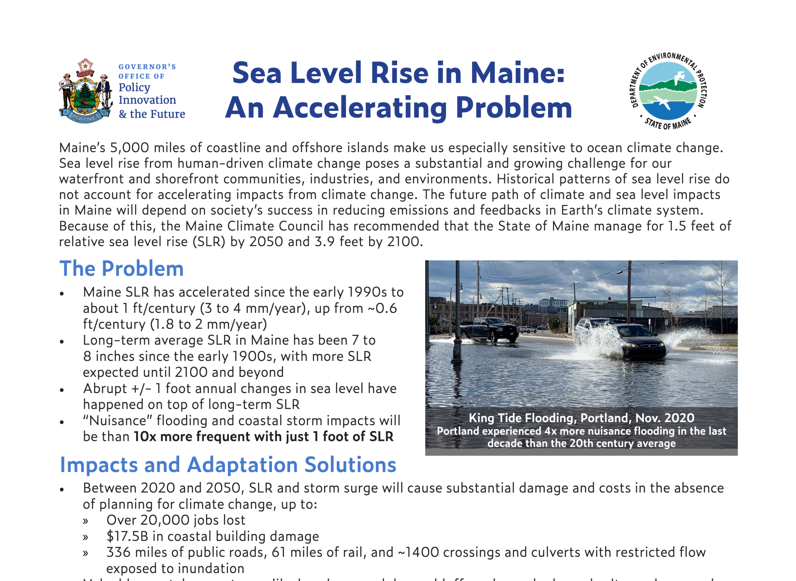
This PDF document provides the scientific data on Maine's sea level rise, its impacts to Maine's coastal economy and future sea level rise projections.
Source: Maine Governor's Office of Policy Innovation and the FutureMaine Sea Level Rise Ticker
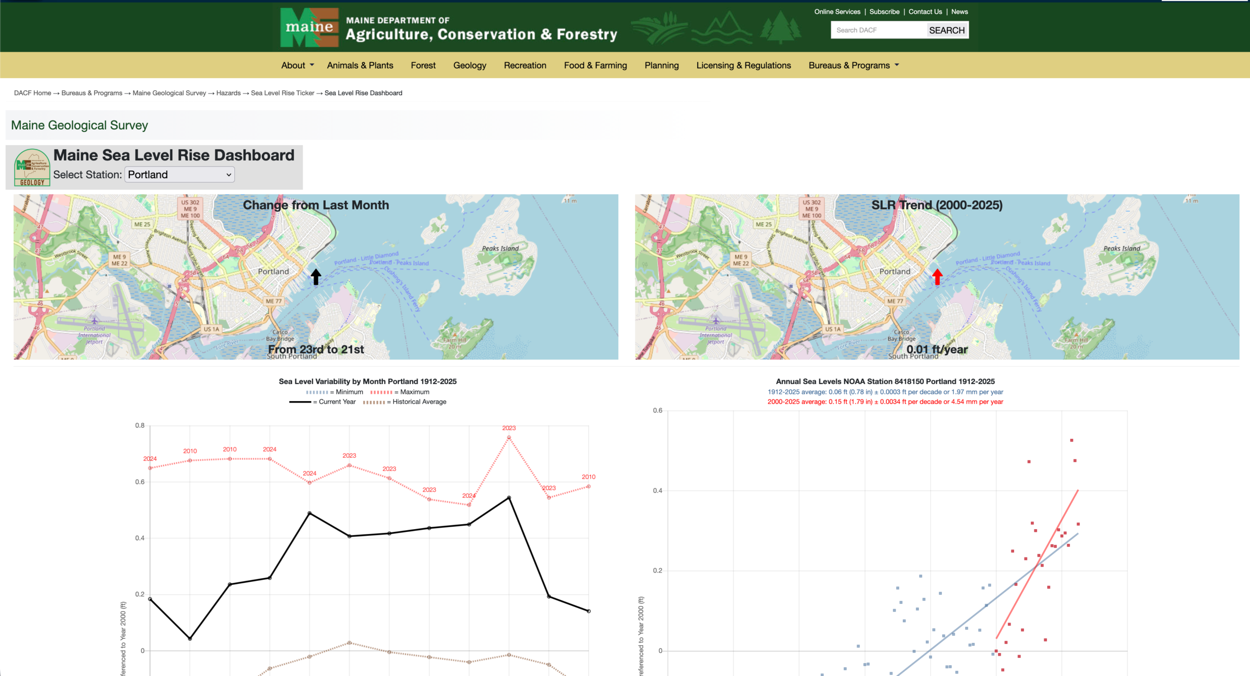
This site tracks water level trends at 5 Maine tide gauges from the early 1900s, and short-term sea level rise since 1993 based on satellite data.
Source: Maine Geological SurveyThe Science Behind Coastal Flooding
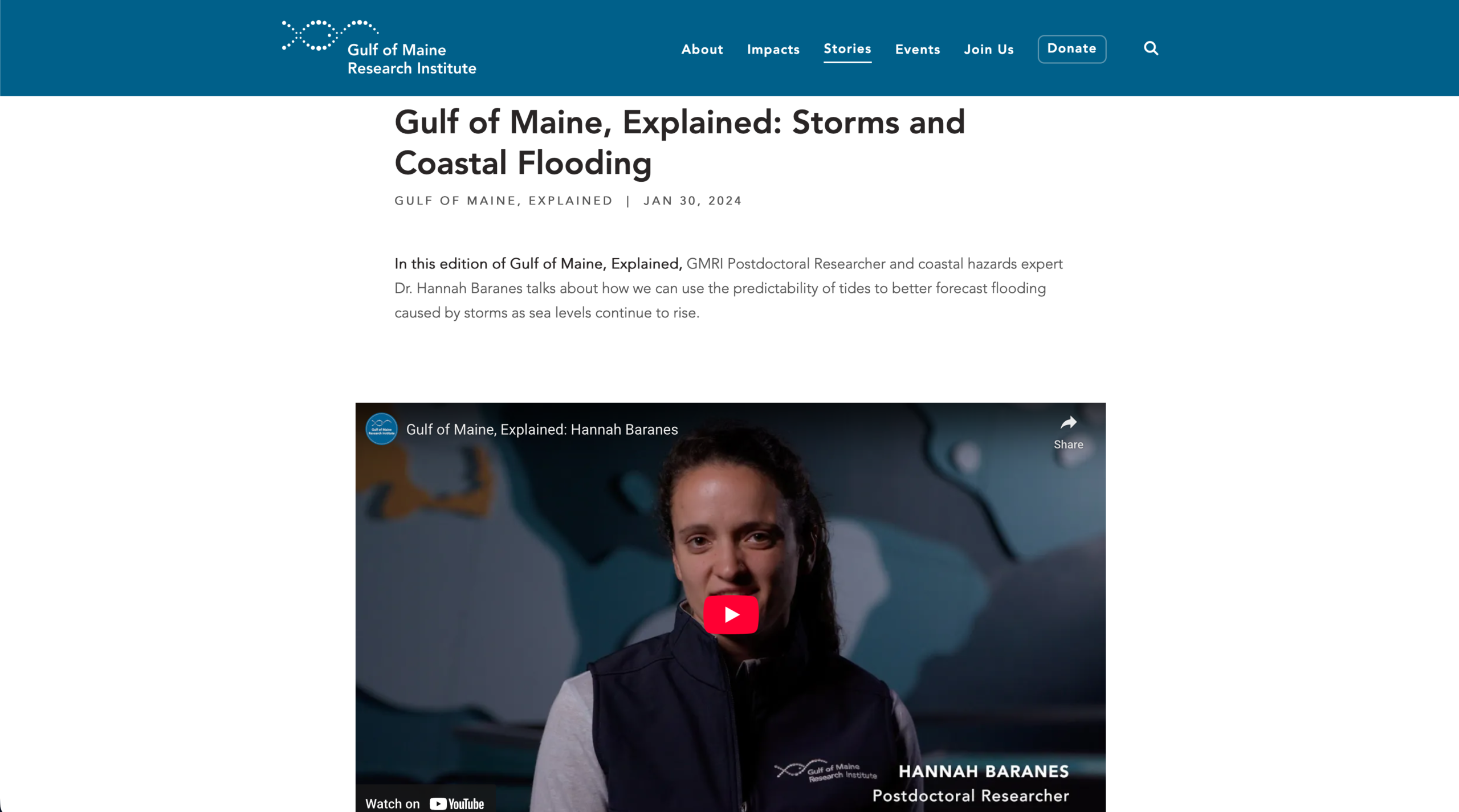
This site explains how Maine communities can use predictable tides to better forecast storm-driven flooding as sea levels continue to rise.
Source: Gulf of Maine Research InstituteHow Climate is Reshaping Coastlines
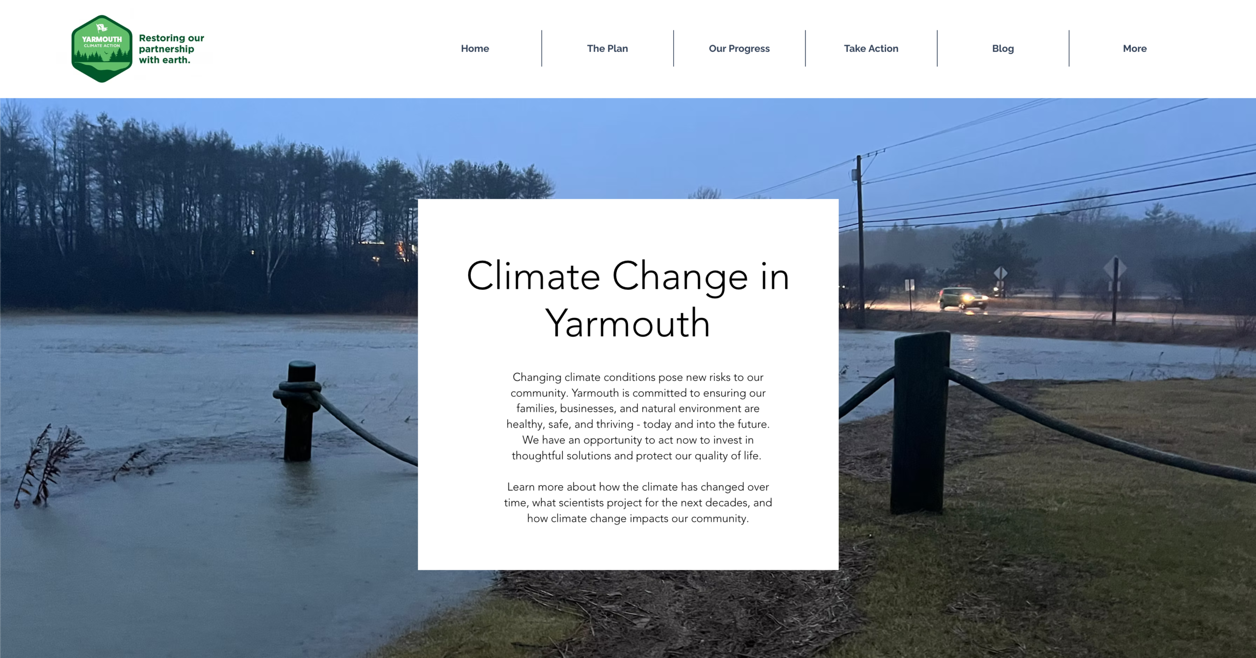
This site clearly explains how climate change is reshaping coastal Maine, what risks lie ahead and the impacts to coastal communities.
Source: Town of Yarmouth Climate Action BoardCasco Bay Studies
Peaks Island 2023 Assessment
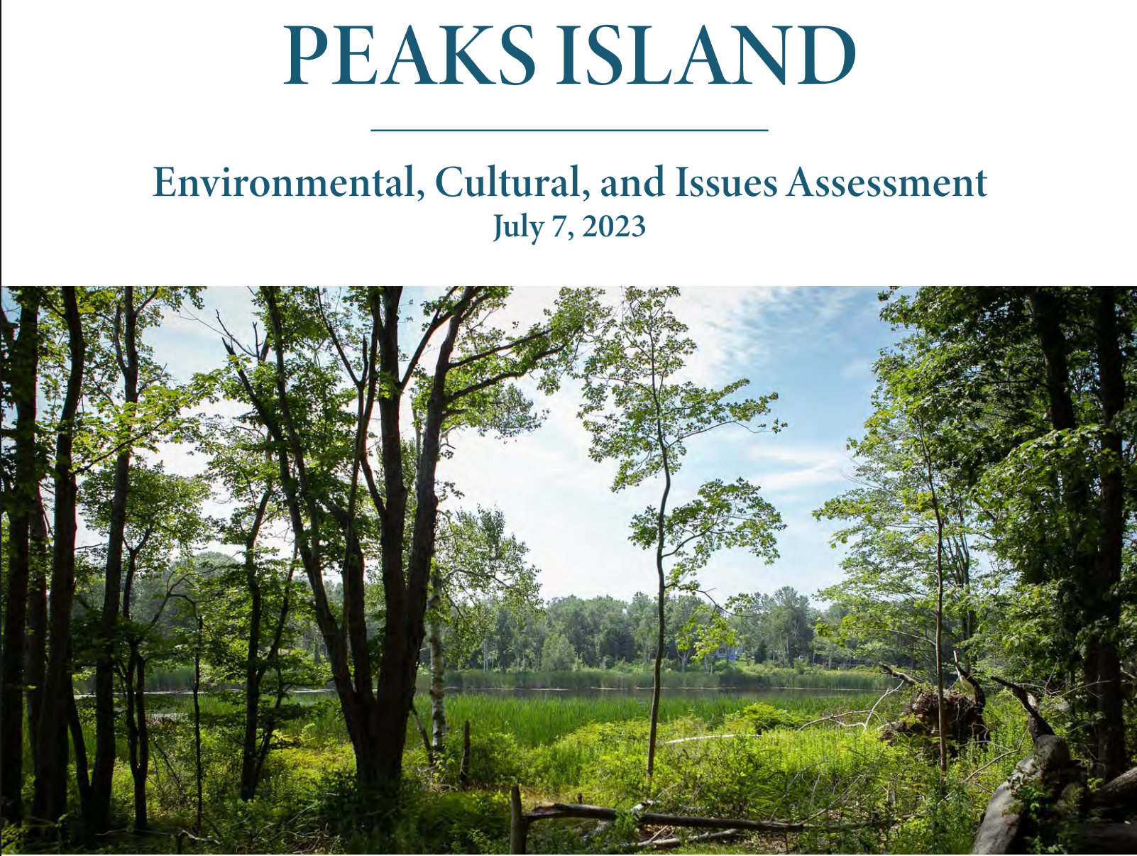
This PDF assessment aims to evaluate current island conditions and identify key challenges and opportunities to guide sustainable planning on Peaks Island.
Source: Peaks Island CouncilChebeague Island Assessment
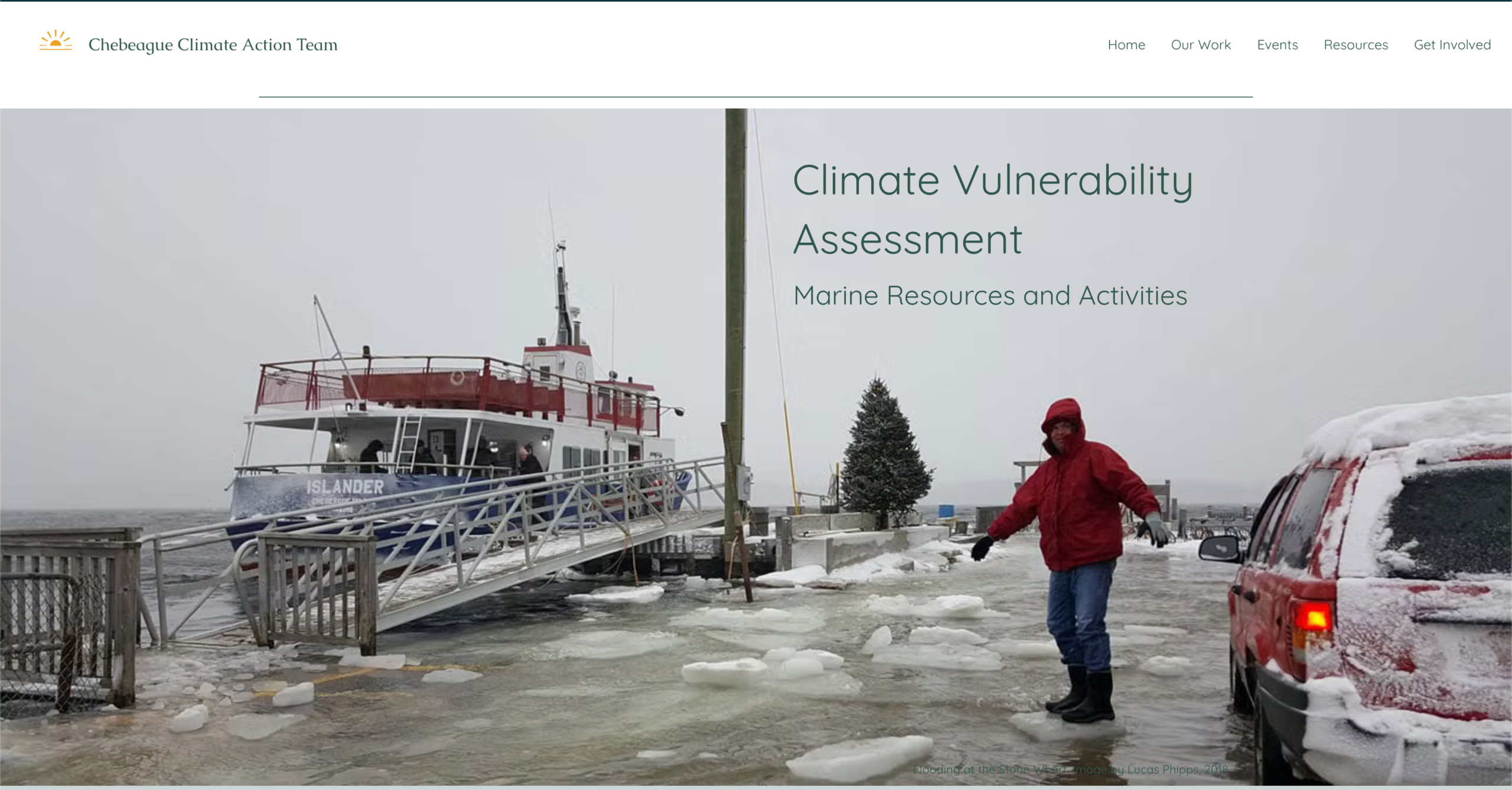
This climate risk study looks at how rising threats could affect the island’s marine ecosystem, economy, and cultural identity.
Source: Chebeague Climate Action TeamTown of Yarmouth Assessment
This PDF assessment identifies climate risks, guides adaptation planning, and is adaptable as conditions change.
Source: Town of YarmouthGreat Diamond Island Assessment
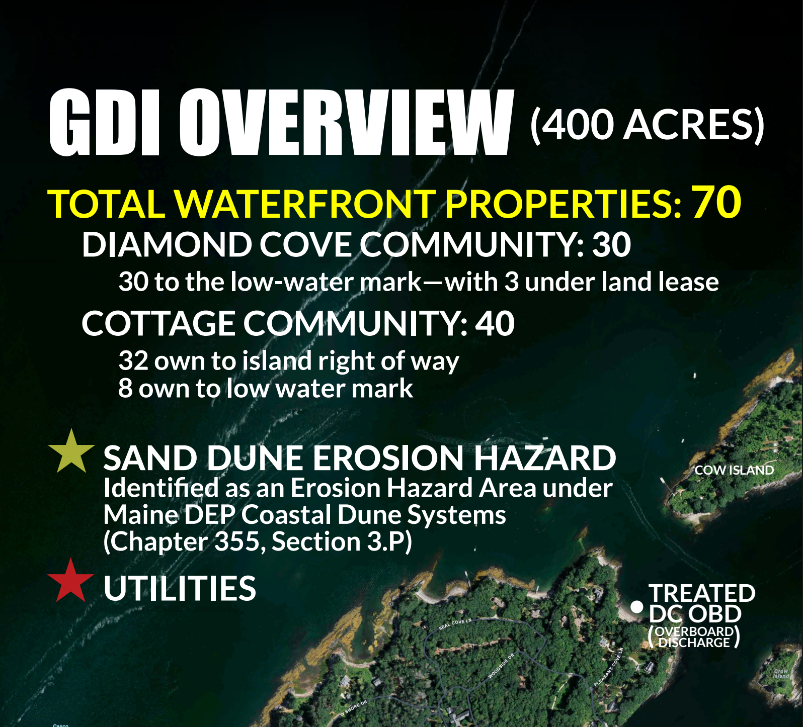
This study is underway with the goal of assessing climate impacts, shoreline erosion, and infrastructure risks for Great Diamond Island.
Source: Great Diamond Island ShoreUp CommitteeAcknowledgements
The Calling Your Bluff project was initiated by the Great Diamond Island Sea Level Rise Partnership and eventually expanded to include several island communities in Casco Bay. This toolkit was developed through a collaboration of islanders from Long, Chebeague, Great Diamond, and Little Diamond Islands to support coastal communities in preparing for sea level rise through guidance and practical information. The Calling Your Bluff project strengthens shoreline resilience through collective planning and education.
In collaboration with Island Institute—which supported development and editing of the toolkit with assistance from the Maine Conservation Corps Shore Corps Stewards Program.
With additional support from the Maine Geological Survey, whose shoreline monitoring expertise and advisory support guided the Calling Your Bluff project.
Funded by
The Maine Coastal Program: The development of this toolkit was led by the Town of Chebeague Island using funds from awards CZM NA24NOSX419C0024 & CZM NA22NOS4190151 to the Maine Department of Marine Resources from the National Oceanic and Atmospheric Administration, U.S. Department of Commerce. The statements, findings, conclusions, and recommendations are those of the author(s) and do not necessarily reflect the views of the National Oceanic and Atmospheric Administration or the Department of Commerce.
Support of this toolkit by the Shore Corps Steward program was made possible in part by the financial assistance provided by the Inflation Reduction Act administered by the Office for Coastal Management, National Oceanic and Atmospheric Administration and in partnership with the Maine Conservation Corps. The content is the responsibility of the authors.
Additionally, Island Institute staff time and Shore Corps Steward travel costs were funded by the Casco Bay Estuary Partnership (CBEP) Resilient Communities Grant administered by the University of Southern Maine and in partnership with the Casco Bay Estuary Partnership.
